
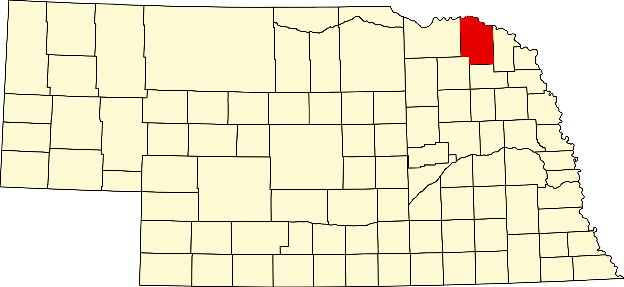
Cedar County, Nebraska
Cedar County is in northeastern Nebraska along the Missouri River, which forms its northern border with South Dakota. Gavins Point Dam stands at its northwest corner, and the free-flowing river below it is part of the Missouri National Recreational River, with public accesses at Nebraska Tailwaters, St. Helena, Bow Creek and Brooky Bottom. Inland the county is rolling farmland cut by Bow Creek and its branches. It covers 746 square miles and had 8,380 people in 2020.
The county was created on February 12, 1857. Its first seat was St. James near the river; the seat moved to St. Helena by 1869, and Hartington has held it since an election on January 20, 1885. German Catholic settlers built the parish churches that still mark the countryside, three of them on the National Register at St. Helena, Bow Valley and Menominee. Randolph, Laurel and Coleridge are the other main towns, and the Cedar County Fair is held at Hartington each July.
US 81 crosses the county north to south and enters South Dakota on the Discovery Bridge at South Yankton. US 20 runs along the south through Randolph, Belden and Laurel; NE 12, the Outlaw Trail Scenic Byway, crosses the north past Fordyce, Wynot and Obert; NE 57 runs north–south through Belden, Coleridge and Hartington; NE 84 crosses east–west through Hartington; and NE 15 runs north through Laurel to the Vermillion–Newcastle Bridge.
Towns of Cedar County
Cities and villages
Hartington
The county seat, a city of 1,517 where NE 57 and NE 84 meet. Home of the 1891–92 courthouse, the Cedar County Fair each July, the county museum, two hotels, a city campground and golf.
Randolph
City of 879 on US 20 in southwestern Cedar County, named for Lord Randolph Churchill and known as the "Honey Capital." Schools, a clinic, library, golf, a motel and the Community Fair and Honey Fest each July.
Laurel
City of 972 where US 20 and NE 15 meet in southeastern Cedar County, named for founder's daughter Laura Martin. Laurel-Concord-Coleridge schools, a clinic, pharmacy, golf, two park campgrounds and Ag Days each June.
Coleridge
Village of 537 on NE 57 between Hartington and Belden, named in 1883 for Lord Coleridge. LCC Middle School, a medical clinic, Park View Haven care center, a village park campground and a bar and grill.
Wynot
Village of 216 just off NE 12 in northeastern Cedar County, said to be named for a settler's "Why not?" K–12 Wynot Public Schools, two campgrounds, and the Missouri River at Bow Creek and Brooky Bottom.
Belden
Village of 112 where NE 57 meets US 20, begun as a railroad water stop and named for paymaster Scott Belden. Grain elevator, a bar and grill and an antique shop; Laurel is 5 miles east.
Fordyce
Village of 133 on a 2-mile spur south of NE 12, founded in 1907 when the Omaha Road came through. St. John the Baptist Church, Boondocks restaurant, and Chalkrock WMA a few miles north.
St. Helena
Village of 91 on a Missouri River bluff at the end of a 5-mile spur off NE 12. County seat until 1885; its 1896–97 Immaculate Conception Church is on the National Register. River access with free camping, and a big Fourth of July.
Magnet
Village of 46 in the southwest corner of Cedar County, platted in 1893 and named to draw settlers "as the magnet attracts iron." Town park and cemeteries; Randolph is about 10 miles south.
Obert
Village of 22 where NE 12 and NE 15 run together in the far northeast of Cedar County, founded in 1907 as Oberton. Park campground and Faith Lutheran Church; Brooky Bottom river access is about 7 miles north.
Aten
Community of 134 on NE 121 between US 81 and Gavins Point Dam, the successor to Green Island, swept away by the 1881 flood. The Nebraska Tailwaters campground and Yankton are minutes away.
Bow Valley
Community of 95 in the West Bow Creek valley, a mile from NE 12 and NE 57. The 1903–04 Sts. Peter and Paul church complex is on the National Register, and East and West Catholic Elementary is here.
Former towns and post office communities
St. James
The first county seat of Cedar County (1857–1869), now a few homes on NE 12 east of Wynot. The 1919 Sts. Philip and James school, on the National Register, houses the St. James Marketplace.
Menominee
Rural German Catholic settlement 1.5 miles east of US 81, home of the 1886 chalk-rock St. Boniface Church, on the National Register. Chalkrock WMA and its 44-acre lake are next door.
Constance
Rural Catholic community in northwestern Cedar County near the Knox County line, centered on St. Joseph Church. Post office 1888–1909; the All Saints Parish supper and bazaar is held here each July.
South Yankton
The Nebraska end of the US 81 crossing to Yankton, S.D., where the 1924 Meridian Bridge, now a walking and biking bridge on the National Register, and the 2008 Discovery Bridge reach the Cedar County shore.
Pleasant Valley
Not a town: the name of two former rural school districts, District 77 near Hartington (1894–1968) and District 39 near Laurel (from 1885).
Cedar County Cameras
Travel Corridors
US Highway 81 — north–south through the west of the county, past Magnet and Fordyce to the Discovery Bridge into Yankton, S.D. US 81 Corridor →
US Highway 20 — east–west across the south through Randolph, Belden and Laurel. US 20 Corridor →
Nebraska Highway 12 (Outlaw Trail Scenic Byway) — east–west across the north, with spurs to Fordyce, St. Helena and Wynot, then through Obert. NE 12 Corridor →
Nebraska Highway 84 — east–west from US 81 through Hartington to NE 15. NE 84 Corridor →
Nebraska Highway 15 — north–south from Wayne through Laurel and Obert to the Vermillion–Newcastle Bridge. NE 15 Corridor →
NE 57, NE 59 and NE 121 — NE 57 runs from Belden through Coleridge and Hartington to NE 12; NE 59 links NE 57 near Coleridge with Laurel, and US 81 with Magnet; NE 121 runs from US 81 at South Yankton past Aten and Gavins Point Dam to Crofton.
Adjacent Counties
Knox County (west) · Pierce County (southwest) · Wayne County (southeast) · Dixon County (east) · Yankton County and Clay County, South Dakota (north, across the Missouri River)
County Seat: Hartington
Founded: Created and organized February 12, 1857
Named For: The cedar groves along the county’s rivers
License Plate Prefix: 13
Population: 8,380 (2020 census)
Area: 746 sq mi
History
Cedar County was created in 1857 and takes its name from the red cedars along the Missouri bluffs. Hartington has been the county seat since 1885, when it won the seat from St Helena in an election on January 20, 1885 — the town was named for the Marquess of Hartington, the British statesman.
The county’s character is German and Luxembourger Catholic, and it shows: Hartington, Fordyce, Constance, St Helena, Bow Valley, Wynot and Menominee all grew around their parishes, and ten of them consolidated their schools into Cedar Catholic High School in 1964. The Saints Peter and Paul Catholic Church Complex at Bow Valley, listed on the National Register in 2000, is the finest building in the county — Late Gothic Revival by Josef Schwartz and Henry Stukenoff, with a 1926 rectory, a school and the 1952 Grotto of Our Lady of Fatima.
Geography
Cedar County covers about 740 square miles in northeast Nebraska, bounded on the north by the Missouri River and the South Dakota line. The north is bluff and chalk-rock country falling to the river; inland it is rolling farmland drained by Bow Creek and its tributaries. It borders Knox County to the west, Pierce County to the southwest, Wayne County to the southeast and Dixon County to the east.
Gavins Point Dam sits on the county line, joining Cedar County to Yankton County, South Dakota — which means the Corps of Engineers recreation areas below the dam are in Nebraska, in Cedar County, despite carrying Yankton mailing addresses.
Outdoors — Camping, RV, Hunting & Fishing
There is no Nebraska state park or state recreation area in Cedar County. The developed camping here is federal — Corps of Engineers ground below Gavins Point Dam — plus municipal sites.
Camping and RV
Cottonwood Recreation Area (Corps of Engineers), on Lake Yankton below the dam. 77 campsites, all with electric. Two modern shower houses with flush toilets, potable water, playground, boat ramp. The dump station is on Toe Road north of the campground, not inside the camping loop — plan the exit. Reservable through recreation.gov.
Nebraska Tailwaters Recreation Area (Corps of Engineers), 55291 Highway 121, on the south bank immediately below the dam. 36 sites — 34 electric, 2 tent-only — plus a group area. RV dump station on site, potable water, modern showers, fish-cleaning station, two-lane boat ramp and an accessible fishing pier. Roughly $18–$20, season reported May to October. Firewood movement is restricted for emerald ash borer.
City of Hartington Campground, Broadway and Felber Streets. Six concrete pads with full hookups — 30 and 50 amp, water and sewer — and a sanitary dump station on site. $25 a night, open year round, but the water is shut off around November 15.
Laurel City Park, 302 Cedar Street. Five sites with 30-amp electric, $10 a night, pay at city hall. There is no dump station at Laurel — the nearest reported is at Ponca, about thirty miles away in Dixon County. Worth knowing before you arrive.
Randolph, Coleridge and Obert have municipal sites, and Bob’s Campground at Randolph is a private full-hookup park on US-20; none publishes reliable hookup or fee detail, so call first. Three river accesses — St Helena, Brooky Bottom and Bow Creek — allow primitive camping. Bow Creek is reachable only from the water: carry-in launch, no vehicle access to the river, no restrooms and no water.
Fishing
Lake Yankton — 332 acres, in Cedar County. Bluegill, carp, channel catfish, crappie, largemouth bass and walleye, with a 15-inch minimum on black bass and a fifteen-a-day panfish bag. Boat ramp at the Cottonwood day-use area.
Chalkrock WMA — a 44-acre lake in the north of the county near Menominee. Bluegill, channel catfish and largemouth bass. No live baitfish may be used or possessed. Boat ramp, but no restrooms.
The Missouri River below Gavins Point is a tailwater fishery, with ramps at Nebraska Tailwaters, Training Dike, St Helena and Brooky Bottom. No Nebraska park entry permit applies anywhere in the county — the WMA, NRD and Corps areas do not require one — just a fishing permit. The current below the dam is serious; the Park Service specifically warns about landing at St Helena.
Hunting
Chalkrock WMA, 130 acres including the lake, is the county’s main public ground — deer, pheasant and waterfowl, owned by the Lewis & Clark NRD and managed with Game and Parks. Wiseman WMA lies in the Missouri bottoms but its acreage and management are not published. Beyond that, Cedar is an Open Fields and Waters and private-permission county; check the current Public Access Atlas.
Note: Buckskin Hills and Powder Creek WMAs are often listed with Cedar County. They are in Dixon County, near Newcastle.
Trails and the byway
The Outlaw Trail Scenic Byway (Nebraska Highway 12) runs the length of northern Cedar County through Wynot. The Training Dike Recreation Area below the dam is day-use only but has a paved multi-purpose trail, a swim beach, two boat ramps and a prairie restoration demonstration area. Goat Island, three miles long and publicly owned, lies opposite Brooky Bottom and allows primitive camping with no facilities whatever. There is no rail-trail in the county.
Events
Events in Cedar County
- Cedar County Fair (Hartington)
Cedar County Fair, a county fair in Hartington, Nebraska.
Know of another event in the county? Tell us about it.
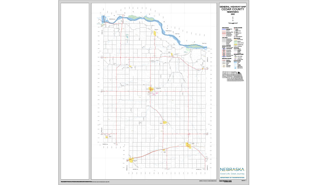
Cedar County at a Glance
Cedar County, Nebraska — about 740 square miles of northeast farmland running up to the Missouri River bluffs, settled by German and Luxembourger Catholic families whose parish churches still mark every village. County seat Hartington. 300 listings across 17 towns.
Getting there: NE-12, the Outlaw Trail Scenic Byway, crosses the north through Wynot; US-20 runs along the south through Randolph and Laurel; NE-15 and NE-57 cross north to south.
For visitors: the Corps of Engineers campgrounds below Gavins Point Dam — Cottonwood and Nebraska Tailwaters, both in Cedar County despite Yankton addresses — with the Missouri tailwater fishery below them. The Saints Peter and Paul Church Complex at Bow Valley, on the National Register. Chalkrock Lake for quiet fishing.
Vehicles registered in Cedar County carry license plate number 13. See what every Nebraska county number means.
Cedar County Businesses & Places
300 listings in Cedar County.
Click a category to see the businesses.
Eat & Drink (17)
- Big Hair Brewhaus — Brewery & Taproom, Hartington
- Blue Heron Bar & Grill — Bar & Grill, Belden
- Boondocks — American Restaurant, Fordyce
- Chief Restaurant and Bar — Bar & Grill, Hartington
- Donnas Diner — Diner / Family Restaurant, Nebraska
- Elsie's Sassy Brew — Cafe / Coffee Shop, Hartington
- Green Diamond — Bar & Grill, Nebraska
- Jerry's Hilltop Cafe and Catering — Diner / Family Restaurant, Nebraska
- Knuckleheadz Bar — Bar & Grill, Laurel
- Ma' Mona Mexican Grill — Mexican Restaurant, Hartington
- Marcy's Mainstreet Bar — Bar & Grill, Hartington
- Nissen Winery & Outlaw Trail Center — Winery & Vineyard, Hartington
- Rodeo's Bar and Grill — Bar & Grill, Coleridge
- Subway – 311 S Robinson Ave, Hartington — Subway, Hartington
- Subway Laurel — Subway, Laurel
- The Scoop Ice Cream & Eats — Ice Cream & Dairy Bar, Laurel
- Z's Korner Kones — Ice Cream & Dairy Bar, Hartington
Stay (7)
- Big Red Inn & Suites — Motel, Laurel
- Cobblestone Inn & Suites - Hartington — Motel, Hartington
- Hotel Hartington — Hotel, Hartington
- K&B Campground — RV Park, Nebraska
- Logan Creek Inn — Motel, Nebraska
- Nebraska Tailwaters Campground & Day-Use Area — RV Park, Aten
- Stonebridge Suites of Hartington — Hotel, Hartington
Outdoors & Recreation (23)
- Bob's Campground — Campgrounds & RV Parks, Nebraska
- Bow Creek Recreation Area — National Parks & Monuments, Nebraska
- Brooky Bottom River Access — Boat Ramps & Marinas, Nebraska
- Cedar County Fairgrounds — Campgrounds & RV Parks, Hartington
- Cedar View Country Club — Country Club, Laurel
- Chalkrock WMA — Public Hunting Areas & WMAs, Nebraska
- City of Hartington Campgrounds — Campgrounds & RV Parks, Hartington
- City of Randolph RV Park — Campgrounds & RV Parks, Nebraska
- Coleridge Disc Golf Course — Disc Golf Course, Coleridge
- Coleridge Village Park — Campgrounds & RV Parks, Coleridge
- Hartington Disc Golf Course — Disc Golf Course, Hartington
- Hartington Golf Club — Golf Course, Hartington
- J&H Storage Campground — Campgrounds & RV Parks, Nebraska
- Laurel City Park — Campgrounds & RV Parks, Laurel
- Laurel Disc Golf Course — Disc Golf Course, Laurel
- Lions Club Park — Campgrounds & RV Parks, Laurel
- Obert Park Campground — Campgrounds & RV Parks, Nebraska
- Pfanny's Farm — Campgrounds & RV Parks, Nebraska
- Randolph Community Golf Course — Golf Course, Nebraska
- Sportsman's Steakhouse, Lounge & RV Park — Campgrounds & RV Parks, Nebraska
- St. Helena River Access — Boat Ramps & Marinas, Nebraska
- Veterans Memorial Park Disc Golf Course — Disc Golf Course, Nebraska
- Wiseman WMA — Public Hunting Areas & WMAs, Nebraska
Places to Visit (7)
- Cedar County Historical Museum — History & Heritage Museums, Hartington
- Laurel City Park — City Parks, Laurel
- Magnet Town Park — City Parks, Magnet
- Meridian Bridge – South Yankton — Bridge, Nebraska
- Obert Park Campground — City Parks, Nebraska
- St. James Marketplace — Attraction, Nebraska
- Wiseman Monument — Historic Marker, Nebraska
Events & Venues (9)
- Broadway Lanes — Bowling Alley, Hartington
- Cedar County Fair — County Fair, Hartington
- Cedar County Fairgrounds — Fairground, Hartington
- Laurel Community Center — Community Center, Laurel
- Laurel Football Field — Athletic Field, Laurel
- Laurel, NE Basketball Court — Basketball Court, Laurel
- REPS Fitness — Gym, Hartington
- Saint Helena Social Club Dancehall — Event Venue / Banquet Hall, Nebraska
- Skylon Ballroom — Event Venue / Banquet Hall, Hartington
Health & Emergency (14)
- Avera Medical Group Hartington — Medical Clinic, Hartington
- Avera Medical Group Willcockson Eye Associates — Optometrist, Hartington
- Balanced Wellness & Massage by Alissa — Massage, Laurel
- Coleridge Medical Clinic — Medical Clinic, Coleridge
- Faith Health Laurel Family Medicine — Medical Clinic, Laurel
- Family 1st Dental of Hartington — Dentist & Dental Office, Hartington
- Filips Vision Source - Hartington — Hartington
- First Chiropractic Centers PC — Chiropractor, Hartington
- Healing Touch — Massage, Coleridge
- Laurel Veterinary Clinic — Mixed / General Practice, Laurel
- Main Street Apothecary — Pharmacy, Laurel
- Randolph Family Practice Clinic — Medical Clinic, Nebraska
- Spier Physical Therapy — Physical Therapy, Hartington
- Steffen Drug — Pharmacy, Hartington
Travel Services (1)
- InCharge Energy Charging Station — Electric Vehicle Charging Station, Hartington
Shopping & Gifts (17)
- 106 Vintage Co — Gift shop, Coleridge
- Buresh Meats — Gift shop, Coleridge
- Burnell's Foodtown — Grocery, Hartington
- Crow's Nest Antiques — Antique Mall, Laurel
- D and J Variety — Gift shop, Hartington
- Dollar General Laurel — Dollar Store, Laurel
- Floral Designs — Florist, Hartington
- Happy Heifer Welding — Arts & Crafts, Belden
- Hartington Ace Hardware — Hardware Store, Hartington
- Hefner Electronics — Gift shop, Coleridge
- Jim's Food Center — Grocery, Nebraska
- Keiths Package Liquor — Gift shop, Hartington
- Laurel Ace Hardware and Rental — Hardware Store, Laurel
- Laurel's Hometown Market — Grocery, Laurel
- Rath's Mini Mart — Liquor Store, Laurel
- The Candi Shop — Antique Mall, Belden
- Vintage Granny — Antique Mall, Laurel
Government & Resources (52)
- Accura HealthCare of Hartington — Assisted Living, Hartington
- Belden Post Office — Post Office, Belden
- Belden Village Office — City Hall, Belden
- Cedar County Assessor — County Assessor, Hartington
- Cedar County Attorney's Office — County Attorney, Hartington
- Cedar County Clerk — County Clerk, Hartington
- Cedar County Court — County Court, Hartington
- Cedar County Courthouse — Court House, Hartington
- Cedar County Driver License Office — County Driver License, Hartington
- Cedar County Emergency Management — Emergency Management, Hartington
- Cedar County Sheriff — County Sheriff, Hartington
- Cedar County Treasurer — County Treasurer, Hartington
- Cedar County Veterans Service Office — Veterans Office, Hartington
- Cedar County Weed Superintendent — County Weed Control, Hartington
- Coleridge Fire Hall — Fire Station, Coleridge
- Coleridge Housing Authority — Housing Authority, Coleridge
- Coleridge Police Department — Police Station, Coleridge
- Coleridge Post Office — Post Office, Coleridge
- Fordyce Fire Hall — Fire Station, Fordyce
- Fordyce Post Office — Post Office, Fordyce
- Fordyce Village Office — City Hall, Fordyce
- Hartington Chamber of Commerce — Chamber of Commerce, Hartington
- Hartington City Hall — City Hall, Hartington
- Hartington Police Department — Police Station, Hartington
- Hartington Post Office — Post Office, Hartington
- Hartington Public Library — Libraries, Hartington
- Hartington Senior Citizens, Inc. — Senior Citizen Center, Hartington
- Hartington USDA Service Center — USDA Service Center (FSA/NRCS), Hartington
- Hillcrest Care Center and Assisted Living — Assisted Living, Laurel
- Laurel Fire and Resque — Fire Station, Laurel
- Laurel Police Department — Police Station, Laurel
- Laurel Post Office — Post Office, Laurel
- Laurel Public Library — Libraries, Laurel
- Laurel Senior Citizens Center 302 E 2nd Street — Senior Citizen Center, Laurel
- Lewis & Clark Natural Resources District — Natural Resources District (NRD), Hartington
- Lied Randolph Public Library — Libraries, Nebraska
- Magnet Fire Hall — Fire Station, Magnet
- Magnet Post Office — Post Office, Magnet
- Magnet Village Office — City Hall, Magnet
- Obert Post Office — Post Office, Nebraska
- Obert Village Office — City Hall, Nebraska
- Park View Haven Nursing Home — Assisted Living, Coleridge
- Randolph City Hall — City Hall, Nebraska
- Randolph Fire Hall — Fire Station, Nebraska
- Randolph Pantry — Food Pantry, Nebraska
- Randolph Police Department — Police Station, Nebraska
- Randolph Post Office — Post Office, Nebraska
- Saint Helena Village Office — City Hall, Nebraska
- St Helena Post Office 68774 — Post Office, Nebraska
- Wynot Fire Hall — Fire Station, Nebraska
- Wynot Post Office — Post Office, Nebraska
- Wynot Village Office — City Hall, Nebraska
Community & Faith (47)
- All Saints Catholic Church Fordyce — Catholic Church, Fordyce
- Amateur Radio Repeaters - Cedar County (via RepeaterBook.com) — Amateur Radio Repeater, Nebraska
- Aten Cemetery — Aten — Cemeteries, Aten
- Belden American Legion — American Legion, Belden
- Belden Cemetery — Belden — Cemeteries, Belden
- Coleridge Cemetery — Coleridge — Cemeteries, Coleridge
- First Congregational UCC — Hartington — Congregational Church, Hartington
- Hartington Cemetery — Hartington — Cemeteries, Hartington
- Holy Trinity Catholic Church Hartington — Catholic Church, Hartington
- Immaculate Conception Catholic Church — Catholic Church, Nebraska
- Immanuel Lutheran Church — Lutheran Church, Coleridge
- Immanuel Lutheran Church - Laurel — Lutheran Church, Laurel
- Laurel Cemetery — Laurel — Cemeteries, Laurel
- Laurel United Methodist Church — Methodist Church, Laurel
- Laurel, United Presbyterian Church — Presbyterian Church, Laurel
- Lawn Ridge Cemetery — Coleridge — Cemeteries, Coleridge
- Magnet Cemetery — Magnet — Cemeteries, Magnet
- Morten Family Cemetery — Hartington — Cemeteries, Hartington
- Norris Cemetery — Coleridge — Cemeteries, Coleridge
- Obert Cemetery — Obert — Cemeteries, Nebraska
- Olive Grove Cemetery — Magnet — Cemeteries, Magnet
- Paragon Cemetery — Hartington — Cemeteries, Hartington
- Pilgrim Congregational UCC — Coleridge — Congregational Church, Coleridge
- Randolph Cemetery — Randolph — Cemeteries, Nebraska
- Randolph, NE First UMC — Methodist Church, Nebraska
- Sacred Heart Catholic Cemetery — Wynot — Cemeteries, Nebraska
- Sacred Heart Catholic Church Wynot — Catholic Church, Nebraska
- Saint Boniface Cemetery — Menominee — Cemeteries, Menominee
- Saint Frances Cemetery — Randolph — Cemeteries, Nebraska
- Saint Helena Cemetery — Saint Helena — Cemeteries, Nebraska
- Saint John Baptist Catholic Church Cemetery — Fordyce — Cemeteries, Fordyce
- Saint Joseph's Catholic Cemetery — Constance — Cemeteries, Constance
- Saint Marys Catholic Cemetery — Saint Helena — Cemeteries, Nebraska
- Saint Michael Cemetery — Coleridge — Cemeteries, Coleridge
- Saint Michaels Cemetery — Hartington — Cemeteries, Hartington
- Saints Peter and Paul Cemetery — Bow Valley — Cemeteries, Bow Valley
- Saints Philip and James Catholic Cemetery — Saint James — Cemeteries, Nebraska
- St. Boniface Catholic Church – Menominee — Catholic Church, Menominee
- St. Jane Frances de Chantal Catholic Church Randolph — Catholic Church, Nebraska
- St. John's Lutheran Church — Lutheran Church, Nebraska
- St. Joseph Catholic Church – Constance — Catholic Church, Constance
- St. Mary Catholic Church Laurel — Catholic Church, Laurel
- St. Michael Catholic Church Coleridge — Catholic Church, Coleridge
- Sts. Peter and Paul Catholic Church – Bow Valley — Catholic Church, Bow Valley
- The Embers — Civic & Community Organizations, Coleridge
- Trinity Lutheran Church — Lutheran Church, Hartington
- Wynot Public Cemetery — Wynot — Cemeteries, Nebraska
Automotive (27)
- AJ Auto — Used Car Dealer, Hartington
- Anderson Body Shop — Auto Repair, Hartington
- Brunssen Repair — Motorcycle Repair Shop, Nebraska
- BV Auto — Auto Repair, Hartington
- Car Wash — Car Wash, Laurel
- Cardinal Express — Fuel & Gas Station, Nebraska
- Caseys General Store — Casey's, Hartington
- Cenex — Cenex, Laurel
- Cubby's Laurel — Cubby's, Laurel
- D and K Trailers — Trailer Sales, Coleridge
- Deanos Mini Mart — Fuel & Gas Station, Coleridge
- Folkers Bros Garage — Auto Repair, Hartington
- Fordyce Auto Repair — Auto Repair, Fordyce
- Gubbels Salvage — Salvage Yard, Nebraska
- Hansen Brothers Parts & Service — Auto Repair, Laurel
- Hansen Repair — Truck Repair Shop, Laurel
- Hartington Chevrolet — Franchised New Car Dealer, Hartington
- Hefner Oil and Feed Company — Auto Repair, Coleridge
- Kardells Auto — Used Car Dealer, Laurel
- Midstates Salvage Inc — Salvage Yard, Nebraska
- Pearson Motor Company — Car Dealership, Hartington
- Peitz GMC Service — Franchised New Car Dealer, Hartington
- Pinkelman Radiator Repair — Auto Repair, Hartington
- Smokin' Diesel Repair — Auto Repair, Laurel
- Stop-N-Go — Fuel & Gas Station, Hartington
- Winkelbauer Auto Sales — Used Car Dealer, Nebraska
- Wynot Oil Co — Auto Repair, Nebraska
Education (18)
- Cedar Catholic High School — Faith-Based School, Hartington
- Cedar County Extension Service — County Extension Office, Hartington
- East and West Catholic Elementary School Hartington — Faith-Based School, Bow Valley
- Hartington Newcastle High School — High School, Hartington
- Hartington-Newcastle Elem at Hartington — Elementary & Middle School, Hartington
- Hartington-Newcastle Public School — School District (K-12 / General), Hartington
- Holy Trinity Elementary School — Faith-Based School, Hartington
- Laurel-Concord-Coleridge Elementary School — Elementary & Middle School, Laurel
- Laurel-Concord-Coleridge High School — High School, Laurel
- Laurel-Concord-Coleridge Middle School — Elementary & Middle School, Coleridge
- Laurel-Concord-Coleridge School — School District (K-12 / General), Laurel
- Randolph Elementary School — Elementary & Middle School, Nebraska
- Randolph High School — High School, Nebraska
- Randolph Public Schools — School District (K-12 / General), Nebraska
- Wynot Elementary School — Elementary & Middle School, Nebraska
- Wynot High School — High School, Nebraska
- Wynot Middle School — Elementary & Middle School, Nebraska
- Wynot Public Schools — School District (K-12 / General), Nebraska
Agriculture & Farm (15)
- B&B Locker LLC — Custom Meat Locker / Processing, Nebraska
- Belden Grain & Feed — Feed & Farm Supply Store, Belden
- Bomgaars – Hartington — Bomgaars, Hartington
- Butch's Propane, LLC — Propane, Nebraska
- CBees Honey — Honey Producer, Nebraska
- Central Valley Ag - Hartington — Farm Coop, Hartington
- Christensen Well & Irrigation, Inc. - Hartington — Well Drilling, Hartington
- Coleridge Grain and Feed — Grain Elevator, Coleridge
- Farmers Union Co-op — Grain Elevator / Cooperative, Hartington
- Grossenburg Implement — Equipment Dealers, Bloomfield
- Hefner Oil and Feed Company — Animal Feed Store, Coleridge
- Keiser Ag & Irrigation — Lindsay / Zimmatic Dealer, Nebraska
- Quality Well Service, LLC — Well Drilling, Nebraska
- Randolph Farm Supply Inc — Animal Feed Store, Nebraska
- Tri-County Feed & Grain — Animal Feed Store, Nebraska
Professional Services (14)
- Anderson and Anderson Insurance — Insurance, Hartington
- Bank of Hartington — Banking, Hartington
- Cedar Security Bank — Banking, Hartington
- Citizens State Bank — Banking, Laurel
- Farm Bureau Financial Services — Insurance, Hartington
- Farmers and Merchants State Bank — Banking, Hartington
- Farmers National Co. - Laurel, NE — Farmers National Company, Laurel
- First National Bank Northeast — Banking, Hartington
- Kennedy Pier Knoff Loftus LLP — Attorney, Hartington
- Kristie’s Rental & Suites — Apartments & Rental Housing, Laurel
- Northeast Nebraska Insurance Agency — Insurance, Coleridge
- Security Bank — Banking, Hartington
- Security Bank - Coleridge — Banking, Coleridge
- Security Bank - Laurel — Banking, Laurel
Utilities (13)
- Bow Valley Water Works — Water Utility / District, Bow Valley
- Cedar-Knox Public Power District — Electric Power Provider, Hartington
- Cedar-Knox Rural Water Project — Water Utility / District, Hartington
- City of Laurel — Water Utility / District, Laurel
- Laurel Municipal Utilities — Electric Power Provider, Laurel
- Randolph Municipal Utilities — Electric Power Provider, Nebraska
- Village of Belden — Water Utility / District, Belden
- Village of Coleridge — Water Utility / District, Coleridge
- Village of Fordyce — Water Utility / District, Fordyce
- Village of Magnet — Water Utility / District, Magnet
- Village of Obert — Water Utility / District, Nebraska
- Village of St Helena — Water Utility / District, Nebraska
- Village of Wynot — Water Utility / District, Nebraska
Trades & Construction (7)
- Anderson Construction — General Contractor, Coleridge
- CL Electric of Nebraska — Electrical, Coleridge
- Coleridge Welding — Welding & Fabrication, Coleridge
- Gerhold Concrete — Ready Mix Concrete Supplier, Hartington
- Happy Heifer Welding — Welding & Fabrication, Belden
- Heine Electric and Irrigation — Electrical, Hartington
- Koch-Tramp Plumbing and Heating — Plumbing & Heating, Hartington
Personal Services (7)
- Broadway Studio — Beauty Salon, Hartington
- Lifestyles Barber and Salon — Beauty Salon, Hartington
- Nancy's Beauty Salon — Beauty Salon, Nebraska
- Shear Image — Beauty Salon, Nebraska
- The Hair Port — Beauty Salon, Nebraska
- Wintz and Ray Funeral Home — Funeral Home, Coleridge
- Wintz Funeral Home — Funeral Home, Hartington
Media (5)
- Cedar County News — News Paper, Hartington
- KDAM 94.3 FM - Hartington — Radio Station, Hartington
- Laurel Advocate — News Paper, Laurel
- Randolph Times — News Paper, Nebraska
- Spirit Catholic Radio 88.3 FM - Hartington — Spirit Catholic Radio, Hartington
Transportation (3)
- Cedar County Transit — Public Transportation, Hartington
- Chan Gurney Municipal Airport — Yankton — Airport, Nebraska
- Hartington Municipal Airport — Municipal / General Aviation Airport, Hartington
Manufacturing & Industrial (1)
- Giant A & M Inc — General / Custom Manufacturing, Laurel