
Nebraska Highway 4: Across the Southern Tier
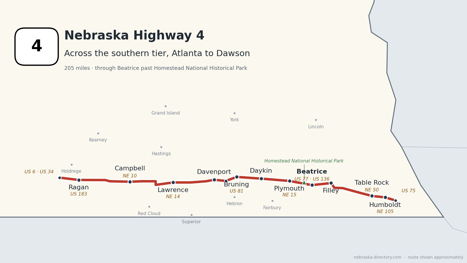
Nebraska Highway 4 runs about 205 miles across the southern tier of the state, from US 6 and US 34 southwest of Atlanta east to US 75 just north of Dawson. It stays within about 25 miles of the Kansas line the whole way and links a string of small farm towns: Ragan, Campbell, Lawrence, Davenport, Bruning, Daykin, Plymouth, Filley, Table Rock and Humboldt. Beatrice is the only town on the road with more than 1,000 people. It is one continuous road through nine counties and shares short stretches with US 281, Nebraska 14, US 81, Nebraska 15, US 136, Nebraska 50 and Nebraska 105.
Before it was 4.
No named auto trail followed this road, but several crossed it. On the 1924 list of Nebraska's named highways, the Meridian Highway, today's US 81, ran north from Hebron and crossed the corridor near Bruning; the Cornhusker Highway ran from Wymore to Lincoln through the Beatrice area; and the North and South Pike ran north from Franklin. The Goldenrod and Midwest highways ran east and west a few miles to the south, through Red Cloud and Fairbury.
The number 4 has been used twice. From 1925 to 1926, Nebraska Highway 4 was the Meridian Highway, which then became US 81. Today's Highway 4 was laid out across the southern counties in 1926.
Most of the towns are railroad towns. The Burlington reached Beatrice in 1871 and later founded Atlanta and Lawrence, the St. Joseph & Grand Island founded Ragan in 1886, and the Atchison & Nebraska built through Table Rock. Campbell, Bruning, Filley and Virginia all grew up around new stations between 1883 and 1887, and Plymouth moved about three miles in 1884 to be on the tracks.
Begin your journey at the west end near Atlanta and head east: across the farm country of Harlan, Franklin and Webster counties, through the small towns of Thayer and Jefferson counties, past Homestead National Historical Park into Beatrice, and on through Table Rock and Humboldt to US 75 near Dawson.
Counties along Highway 4, west to east: Harlan · Franklin · Webster · Nuckolls · Thayer · Jefferson · Gage · Pawnee · Richardson
Harlan County on Highway 4
Ragan and the west end.
On the road: Ragan (US 183) · Atlanta (just north of the west end) · Holdrege (north on US 183) · Alma (south on US 183) · Harlan County page
Highway 4 begins at US 6 and US 34 southwest of Atlanta and runs east past Ragan, crossing US 183, which leads north to Holdrege and south to Alma and Harlan County Reservoir.
History along the road. Ragan was platted in 1886 on the St. Joseph & Grand Island Railroad and named for a railroad lawyer; it had 22 people in 2020. Atlanta, just north of the west end, was the site of Camp Atlanta, a World War II camp for German prisoners of war. The Nebraska Prairie Museum in Holdrege tells the story of Phelps County.
Franklin County on Highway 4
Campbell.
On the road: Campbell · Upland and Hildreth (north on NE 10) · Franklin (south on NE 10) · Franklin County page
The road crosses Nebraska 44, which runs north toward Wilcox, and Nebraska 10, which leads north to Upland, Hildreth and Minden and south to Franklin, then reaches Campbell.
History along the road. Campbell was platted in 1886 on a new rail line and named for one of its founders. Harold Warp Pioneer Village, a museum of everyday American life founded in 1953, is north in Minden by way of Highway 10.
Webster County on Highway 4
Bladen and Blue Hill.
On the road: Bladen (spur) · Blue Hill (north on US 281) · Red Cloud (south on US 281) · Guide Rock (south on NE 78) · Webster County page
Highway 4 passes a short spur to Bladen and shares about four miles with US 281 south of Blue Hill; US 281 leads south to Red Cloud. Nebraska 78 heads south to Guide Rock.
History along the road. Bladen was founded in 1886 on the Burlington & Missouri River Railroad and has hosted the Webster County Fair since 1906. Blue Hill dates from 1878 on the same line. Red Cloud, about 15 miles south, was Willa Cather's hometown and is home to the National Willa Cather Center.
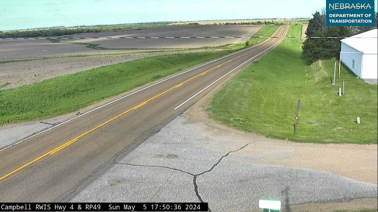
Live cameras. Images from Nebraska 511; click one to open it full size.
Nuckolls County on Highway 4
Lawrence.
On the road: Lawrence · Oak (spur) · Nelson (south on NE 14) · Nuckolls County page
The road runs through Lawrence and shares a mile with Nebraska 14, which leads south to Nelson, the county seat, and Superior. A spur of about five miles leads to Oak.
History along the road. Lawrence was platted in 1886 on the Chicago, Burlington & Quincy and named for a railroad official. Oak began in 1888 on the Fremont, Elkhorn & Missouri Valley.
Thayer County on Highway 4
Davenport, Carleton and Bruning.
On the road: Davenport · Carleton (NE 5) · Bruning (US 81) · Hebron (south on US 81) · Thayer County page
Highway 4 runs through Davenport and Carleton, where Nebraska 5 heads south to Deshler, then shares a mile with US 81 at Bruning; US 81 leads south to Hebron, the county seat. A historical marker for Bruning Army Air Field stands on Highway 4 about six miles east of Bruning.
History along the road. Davenport was platted in 1872 and named for Davenport, Iowa. Bruning, founded in 1887, is where Ed Yost made the first free flight of a modern hot-air balloon in October 1960. Bruning Army Air Field trained B-24 bomber crews from 1943 to 1945.
Jefferson County on Highway 4
Daykin and Plymouth.
On the road: Daykin · Plymouth (NE 15) · Fairbury (south on NE 15) · Jefferson County page
The road runs through Daykin, where Nebraska 53 ends, and shares a mile with Nebraska 15 between Daykin and Plymouth; Highway 15 leads south to Fairbury, the county seat.
History along the road. Daykin is named for John Daykin, a conductor on Abraham Lincoln's funeral train, and is known as the Windmill Town. Plymouth was settled in 1872 by a New England colony, named for Plymouth, Massachusetts, and moved about three miles in 1884 to be on the railroad.
Live cameras. Images from Nebraska 511; click one to open it full size.
Gage County on Highway 4
Beatrice and Homestead National Historical Park.
On the road: Homestead National Historical Park · Beatrice (US 136, US 77) · Filley · Virginia · Gage County page
Highway 4 passes Nebraska 103, then reaches Homestead National Historical Park about four miles west of Beatrice. It runs through Beatrice, the county seat, crossing US 77, and shares about 11 miles with US 136, the Heritage Highway, east to Filley before continuing to Virginia.
History along the road. Homestead National Historical Park marks the claim of Daniel Freeman, one of the first homesteaders under the Homestead Act of 1862. It became a national monument in 1936 and was renamed in 2021, and its Freeman School dates from 1872. Beatrice was founded in 1857 and named for Julia Beatrice Kinney; the Burlington arrived in 1871, and the Gage County Museum is in its 1906 depot. Near Filley, the Elijah Filley Stone Barn, built in 1874, is called the largest limestone bank barn in Nebraska.
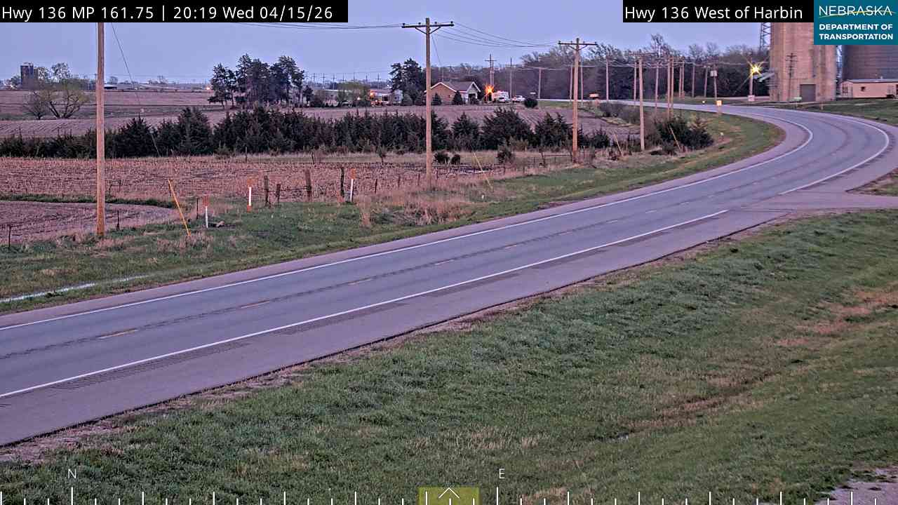
Live cameras. Images from Nebraska 511; click one to open it full size.

Pawnee County on Highway 4
Lewiston and Table Rock.
On the road: Lewiston (spur) · Pawnee City (south on NE 99 or NE 50) · Table Rock · Pawnee County page
The road passes a spur to Lewiston, then Nebraska 99, which leads south to Burchard and Pawnee City, the county seat. After a short jog with Nebraska 50 it reaches Table Rock.
History along the road. Table Rock was platted in 1855 and named for a rock formation on the Nemaha River that is now gone. It calls itself "the Museum Town," with nine museums, among them its 1893 Opera House.
Richardson County on Highway 4
Humboldt and the east end.
On the road: Humboldt (NE 105) · Kirkman's Cove (2.5 miles west of Humboldt) · Dawson (US 75) · Richardson County page
Highway 4 shares about three and a half miles with Nebraska 105 at Humboldt and ends at US 75 just north of Dawson.
History along the road. Humboldt was platted in 1868 and named for Humboldt, Tennessee. Its town square, with a bandstand dedicated in 1912, is the heart of a commercial historic district listed on the National Register in 2005, and the Quad County Museum is on the square.
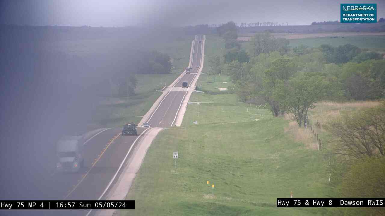
Live cameras. Images from Nebraska 511; click one to open it full size.
Nebraska Road Conditions & Highway 4 Travel Tips
Highway 4 is two lanes all the way, with long stretches between towns. In Pawnee County, the road between Nebraska 99 and Nebraska 50 is closed for bridge work from August 2026 to about May 2027, with a posted detour. There is also lane work near Davenport and just west of Beatrice in 2026. Check current conditions before you travel.
RV Travel & Camping Along Highway 4
- Rockford Lake State Recreation Area — near Beatrice
- Kirkman's Cove Recreation Area — west of Humboldt
Related Nebraska Travel Corridors
- US Highway 6 — at the west end near Atlanta
- US Highway 183 — at Ragan
- US Highway 281 — near Blue Hill
- Highway 14 — near Lawrence
- US Highway 81 — at Bruning
- Highway 15 — near Plymouth
- US Highway 136 — Beatrice to Filley
- Highway 50 — near Table Rock
- US Highway 75 — at Dawson
- ← Explore All Nebraska Travel Corridors