
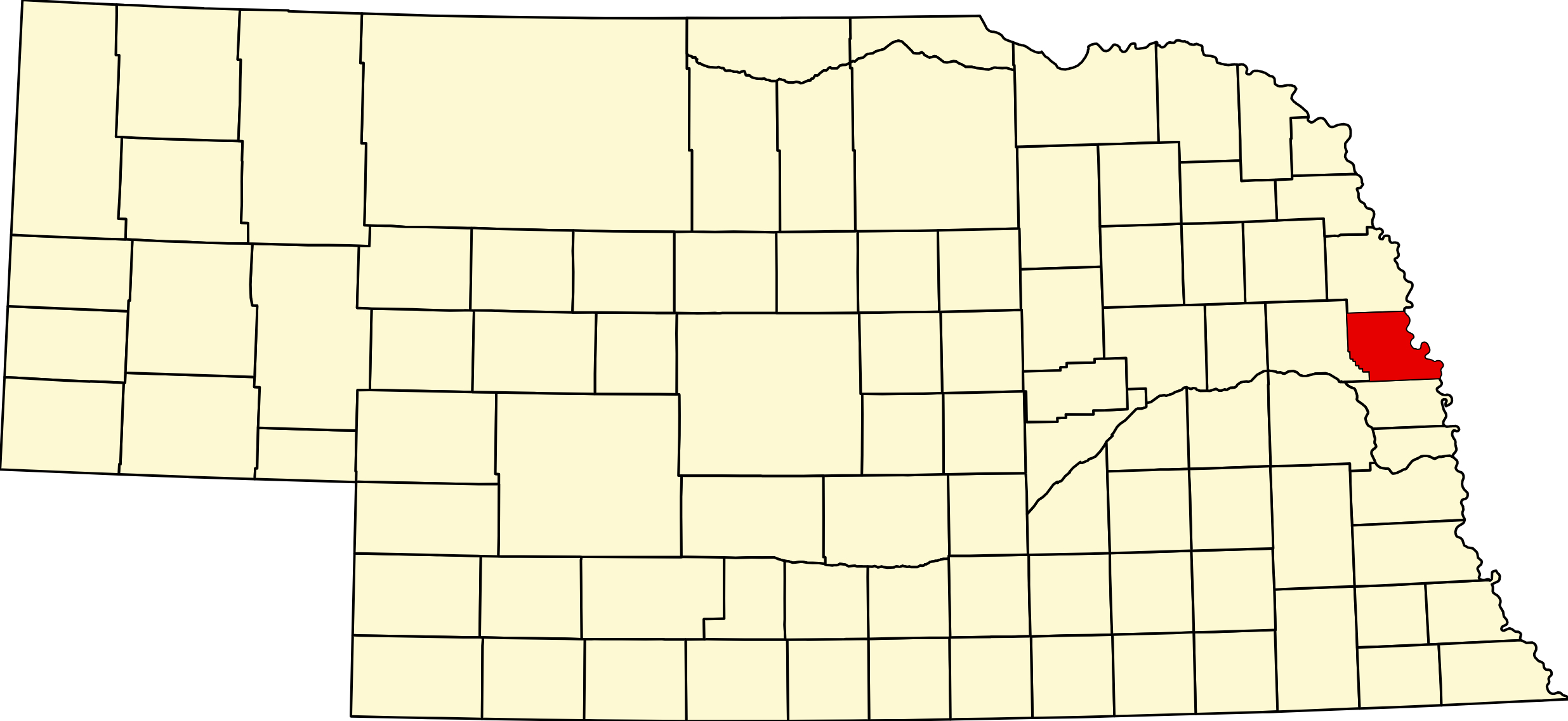
Washington County, Nebraska
County seat: Blair · Created: November 23, 1854 · Named for: George Washington · License plate prefix: 29 · Population: 20,865 (2020 census) · Area: 390 sq mi of land
About Washington County
Washington County is one of the eight counties proclaimed by acting Governor Thomas B. Cuming on November 23, 1854; the legislature fixed its boundaries on February 22, 1855, Washington's birthday. History here runs deep: Lewis and Clark held their first council with the Otoe and Missouria at Council Bluff in 1804, and the Army's Fort Atkinson (1820–1827), the first U.S. post west of the Missouri, stood beside today's Fort Calhoun.
The county seat moved from Fort Calhoun to the boom town of De Soto in 1858, back to Fort Calhoun in 1866, and to Blair in 1869, the year the Sioux City & Pacific Railroad founded Blair, Kennard and Bell Creek, now Arlington. In 1860 the west line moved to the Elkhorn River, taking in Fontanelle. Danish Lutherans built Dana College at Blair (1884–2010). Today the county is part of the Omaha metro area; it has grown at every census since 1950, and Cargill's biorefinery campus at Blair is its largest employer.
Towns of Washington County
Cities and villages
Blair
The county seat, a city of 7,790 on the bluffs above the Missouri where US 30 crosses into Iowa. Memorial Community Hospital, the 1891 courthouse, Black Elk–Neihardt Park, the Cargill biorefinery and Gateway to the West Days each June.
Fort Calhoun
City of 1,108 on US 75 beside Fort Atkinson, the first U.S. Army post west of the Missouri (1820–1827). Fort Atkinson State Historical Park, the Washington County Museum and Boyer Chute National Wildlife Refuge.
Arlington
Nebraska's largest village, 1,300 people on US 30 near the Elkhorn River. Laid out as Bell Creek in 1869, home of Marshall's Nurseries and the Washington County Fair.
Kennard
Village of 381 just north of US 30, about 7 miles southwest of Blair, founded with the railroad in 1869 and named for Nebraska's first secretary of state. Birthplace of fruit breeder Floyd Zaiger.
Herman
Village of 247 on US 75 between Blair and Tekamah, laid out on the railroad in 1871 as the successor of Cuming City. Rebuilt after the tornado of 1899; Herman Days each September.
Washington
Village of 129 near the Douglas County line, platted on the railroad in 1887 and named for the county. About 6 miles north of Bennington on spur S-28J.
Former towns and post office communities
De Soto
Ghost town on the Missouri bottoms 4 miles southeast of Blair, a boom town of several hundred in 1857 and county seat from 1858 to 1866. The DeSoto National Wildlife Refuge and the steamboat Bertrand collection carry its name.
Fontanelle
Territorial town of 1854 on NE 91 above the Elkhorn, founded by a colony from Quincy, Illinois. First seat of Dodge County and home of Nebraska University (1855–1872), forerunner of Doane College.
Nashville
Roadside community on US 75 about 4 miles south of Fort Calhoun, just north of Omaha. Post office 1922–1929.
Orum
Rural crossroads in Danish farm country about 8 miles west of Blair. Post office 1890–1904; Immanuel Lutheran Church and the Danish Lincoln Lutheran Cemetery remain.
Spiker
Ghost town in the hills of northwestern Washington County, about 7 miles southwest of Herman. A store and post office from 1890 to 1902; abandoned after a fire in the late 1930s.
Telbasta
Rural hamlet in western Washington County, about 4 miles northeast of Fontanelle. Post office 1890–1900; Salem Lutheran Church, founded in 1860, stands nearby.
Cuming City
Territorial town of 1854 on the bluffs northwest of Blair, with 53 houses by 1857; its post office moved to Herman in 1872. The pioneer cemetery is now a native prairie preserve.
Travel Corridors
US Highway 30 — the Lincoln Highway, from Fremont through Arlington and past Kennard to Blair and across the Missouri River to Iowa. US 30 Corridor →
US Highway 75 — along the river bluffs from Omaha through Nashville, Fort Calhoun and Blair to Herman and Tekamah. US 75 Corridor →
NE 91 and NE 133 — NE 91 runs west from Blair past Fontanelle to Nickerson and Hooper. NE 91 Corridor → NE 133, the four-lane Blair High Road, runs south from Blair to Omaha.
Cameras: View Washington County cameras → · Road conditions: Nebraska 511
Outdoors
Fort Atkinson State Historical Park in Fort Calhoun has the rebuilt fort, a visitor center (May to early October) and living-history weekends on the first weekend of each month, May through October; no camping. The DeSoto National Wildlife Refuge, east of Blair on both sides of the river, has DeSoto Lake, the steamboat Bertrand collection and fall waterfowl; $3 per vehicle. Boyer Chute National Wildlife Refuge, east of Fort Calhoun, has about 8 miles of free trails along a restored Missouri River chute.
Camping: Bob Hardy RV Park in Blair has eight electric sites, tent sites, showers and a dump station; private marinas with RV sites line the river north of Blair. Wilson Island State Recreation Area in Iowa is a few miles east. Golf: River Wilds Golf Club, 14002 US 75, Blair; 18 holes, par 72, public.
Washington County Business Directory
Businesses within 20 miles of: Blair · Fort Calhoun · Arlington · Kennard · Herman · All listings →
Adjacent Counties
Burt County (north) · Dodge County (west) · Douglas County (south) · Harrison and Pottawattamie counties, Iowa (east, across the Missouri River)
Events
Blair's Gateway to the West Days fills the first weekend of June (June 4–7 in 2026). Fort Atkinson holds living-history weekends from May to October and a candlelight tour in November (November 7, 2026). The Washington County Fair runs at Arlington in late July and early August (July 31–August 5 in 2026), and Herman Days is held in September.
Events in Washington County
- Washington County Fair (Arlington)
Washington County Fair, a county fair in Blair, Nebraska.
Know of another event in the county? Tell us about it.
Washington County Road Map
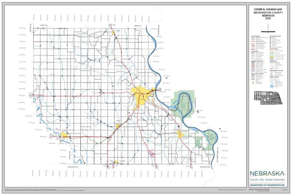
Download the full-size, printable county road map (PDF, Nebraska Dept. of Transportation)
Washington County at a Glance
Washington County, Nebraska — one of the eight original counties of Nebraska Territory, on the Missouri River just north of Omaha. County seat Blair.
Getting there: US 75 and NE 133 from Omaha, US 30 from Fremont and from Iowa across the Blair bridge, NE 91 from the west.
For visitors: Fort Atkinson State Historical Park and the Washington County Museum in Fort Calhoun, the DeSoto and Boyer Chute wildlife refuges, Black Elk–Neihardt Park in Blair, and the territorial town of Fontanelle. Memorial Community Hospital in Blair serves the county.
Vehicles registered in Washington County carry license plate number 29. See what every Nebraska county number means.
Washington County Businesses & Places
185 listings in Washington County.
Click a category to see the businesses.
Eat & Drink (19)
- Blair Classic Cafe — Diner / Family Restaurant, Blair
- Bluejays Ice Cream and Candy — Ice Cream & Dairy Bar, Blair
- Burger King Blair — Burger King, Blair
- Butchs Rockn Deli — Sandwich & Deli, Blair
- Connie's Blair Bakery — Bakery, Blair
- Dulce Vida – Blair — American Restaurant, Blair
- El Vallarta Mexican Restaurant – Blair — Mexican Restaurant, Blair
- Fontanelle Orchard — Farmers Market & Local Produce, Fontanelle
- Hardee's Blair — Hardee's, Blair
- Jimmy John's - Blair (2075 S 20th St) — Jimmy John's, Blair
- Mandarin House – Blair — Chinese Restaurant, Blair
- McDonald's - Blair (929 Washington St) — McDonald's, Blair
- Pizza Hut — Pizza Restaurant, Blair
- Red Brick Grill and Bar — American Restaurant, Blair
- Runza Blair — Runza, Blair
- Subway – 1414 Washington Street, Blair — Subway, Blair
- The Rustic — American Restaurant, Fort Calhoun
- Too Far North — Bar, Fort Calhoun
- Viking Steaks and Seafood — Seafood Restaurant, Blair
Stay (2)
- Holiday Inn Express – Blair — Hotel, Blair
- Super 8 – Blair — Motel, Blair
Outdoors & Recreation (5)
- Bell Creek Disc Golf Park — Disc Golf Course, Arlington
- Bob Hardy RV Park — Campgrounds & RV Parks, Blair
- Camp Fontanelle — Campgrounds & RV Parks, Fontanelle
- Fort Calhoun Disc Golf Course — Disc Golf Course, Fort Calhoun
- River Wilds Golf Club — Golf Course, Blair
Places to Visit (9)
- Black Elk–Neihardt Park — City Parks, Blair
- Boyer Chute National Wildlife Refuge — Wildlife Refuge, Fort Calhoun
- DeSoto National Wildlife Refuge — Wildlife Refuge, De Soto
- DeSoto Townsite Historical Marker — Historic Marker, De Soto
- Fontanelle Township Hall — Attraction, Fontanelle
- Fort Atkinson State Historical Park — State Historical Parks, Fort Calhoun
- Frahm House — Attraction, Fort Calhoun
- Lewis and Clark Campsite Marker – Blair — Historic Marker, Blair
- Washington County Museum — History & Heritage Museums, Fort Calhoun
Events & Venues (2)
- Washington County Fair — County Fair, Arlington
- Washington County Fairgrounds — Fairground, Arlington
Health & Emergency (4)
- Fort Calhoun Clinic — Medical Clinic, Fort Calhoun
- Larimore Massage & Bodywork — Massage, Blair
- Memorial Community Hospital & Health System — Hospital, Blair
- Memorial Community Hospital Corporation — Medical Clinic, Blair
Shopping & Gifts (2)
- ACME Fabric & Quilt Co. — Fabric & Quilt Shop, Blair
- Family Fare Supermarkets – Blair — Grocery, Blair
Community & Faith (48)
- Admah Cemetery — Herman — Cemeteries, Herman
- Amateur Radio Repeaters - Washington County (via RepeaterBook.com) — Amateur Radio Repeater, Nebraska
- Arlington Cemetery — Arlington — Cemeteries, Arlington
- Arlington Community Church UCC — Arlington — Congregational Church, Arlington
- Blair Cemetery — Blair — Cemeteries, Blair
- Blair Church of Christ — Other Denomination, Blair
- Blair First UMC — Methodist Church, Blair
- Blair Potters Field Cemetery — Blair — Cemeteries, Blair
- Brewster Cemetery — Kennard — Cemeteries, Kennard
- Church of Jesus Christ of Latter-day Saints — Blair — Latter-day Saints / Community of Christ, Blair
- Colby-Morley Cemetery — Arlington — Cemeteries, Arlington
- Cuming City Cemetery and Prairie Preserve — Cemeteries, Cuming City
- De Soto Cemetery — De Soto — Cemeteries, De Soto
- Emmaus Lutheran Church — Lutheran Church, Kennard
- Fairview Cemetery — De Soto — Cemeteries, De Soto
- First Baptist Church - Blair — Baptist Church, Blair
- First Lutheran Church — Lutheran Church, Blair
- Fontanelle Lutheran Cemetery — Fontanelle — Cemeteries, Fontanelle
- Fort Calhoun Cemetery — Fort Calhoun — Cemeteries, Fort Calhoun
- Fort Calhoun Presbyterian Church — Presbyterian Church, Fort Calhoun
- German Cemetery — Blair — Cemeteries, Blair
- God’s Acre Cemetery — Arlington — Cemeteries, Arlington
- Hartung Cemetery — Arlington — Cemeteries, Fontanelle
- Herman Cemetery — Herman — Cemeteries, Herman
- Holy Cross Cemetery — Blair — Cemeteries, Blair
- Immanuel Cemetery Old — Arlington — Cemeteries, Arlington
- Immanuel Evangelical Lutheran Cemetery — Blair — Cemeteries, Blair
- Immanuel Lutheran Church (Orum) — Lutheran Church, Nebraska
- Kennard Cemetery — Kennard — Cemeteries, Kennard
- Kennard Grace UMC — Methodist Church, Kennard
- Lincoln Lutheran Cemetery — Orum — Cemeteries, Nebraska
- Living Hope Assembly of God — Pentecostal, Blair
- New England Cemetery — Blair — Cemeteries, Blair
- Pioneer Memorial Cemetery — Fort Calhoun — Cemeteries, Fort Calhoun
- Prairie View Cemetery — Kennard — Cemeteries, Kennard
- Rose Hill Cemetery — Orum — Cemeteries, Nebraska
- Salem Lutheran Church — Lutheran Church, Fontanelle
- Shipley Cemetery — Fort Calhoun — Cemeteries, Fort Calhoun
- St. Francis Borgia Catholic Church Blair — Catholic Church, Blair
- St. John the Baptist Catholic Church Fort Calhoun — Catholic Church, Fort Calhoun
- St. Mary's Episcopal Church — Episcopal Church, Blair
- St. Paul’s Lutheran Church — Lutheran Church, Arlington
- Telbasta Cemetery — Arlington — Cemeteries, Nebraska
- The Blair Congregational UCC — Blair — Congregational Church, Blair
- Thone Cemetery — Herman — Cemeteries, Herman
- Trinity Lutheran Church — Lutheran Church, Blair
- Vacoma Cemetery — Arlington — Cemeteries, Arlington
- Wilcox Cemetery — Fort Calhoun — Cemeteries, Fort Calhoun
Government & Resources (30)
- Arlington Post Office — Post Office, Arlington
- Arlington Public Library — Libraries, Arlington
- Arlington Senior Center — Senior Citizen Center, Arlington
- Blair City Hall — City Hall, Blair
- Blair Fire Department — Fire Station, Blair
- Blair Housing Authority — Housing Authority, Blair
- Blair Police Department — Police Station, Blair
- Blair Post Office — Post Office, Blair
- Blair Public Library & Technology Center — Libraries, Blair
- Blair USDA Service Center — USDA Service Center (FSA/NRCS), Blair
- Fort Calhoun City Hall — City Hall, Fort Calhoun
- Fort Calhoun Fire Hall — Fire Station, Fort Calhoun
- Fort Calhoun Post Office — Post Office, Fort Calhoun
- Fort Calhoun Public Library — Libraries, Fort Calhoun
- Herman Fire Hall — Fire Station, Herman
- Herman Post Office — Post Office, Herman
- Joseph's Coat — Food Pantry, Blair
- Washington County Assessor — County Assessor, Blair
- Washington County Attorney's Office — County Attorney, Blair
- Washington County Chamber of Commerce — Chamber of Commerce, Blair
- Washington County Clerk — County Clerk, Blair
- Washington County Court — County Court, Blair
- Washington County Courthouse — Court House, Blair
- Washington County Driver License Office — County Driver License, Blair
- Washington County Emergency Management — Emergency Management, Blair
- Washington County Sheriff — County Sheriff, Blair
- Washington County Treasurer — County Treasurer, Blair
- Washington County Veterans Service Office — Veterans Office, Blair
- Washington County Weed Superintendent — County Weed Control, Blair
- Washington Village Office — City Hall, Nebraska
Automotive (14)
- Balls Out Motors — Used Car Dealer, Blair
- C & R Automotive — Auto Repair, Blair
- Casey's General Store - Blair — Casey's, Blair
- Chief Classic Auto Sales — Classic & Collector Cars, Arlington
- Country Auto — Used Car Dealer, Blair
- Country Tire Automotive Blair — Auto Repair, Blair
- Mikes Big Truck Sales — Truck Dealership, Blair
- Omega Repair — Auto Repair, Fort Calhoun
- Sid Dillon Chevrolet Blair — Franchised New Car Dealer, Blair
- Smittys Auto Service — Auto Repair, Blair
- Total Truck & Machine — Truck Dealership, Blair
- Wheeler Automotive — Used Car Dealer, Fort Calhoun
- Woodhouse Chrysler Dodge Jeep Ram — Blair — Franchised New Car Dealer, Blair
- Woodhouse Ford — Blair — Franchised New Car Dealer, Blair
Education (13)
- Arlington Elementary School — Elementary & Middle School, Arlington
- Arlington High School — High School, Arlington
- Arlington Public Schools — School District (K-12 / General), Arlington
- Blair Arbor Park Elementary — Elementary & Middle School, Blair
- Blair Community Schools — School District (K-12 / General), Blair
- Blair Deerfield Elementary — Elementary & Middle School, Blair
- Blair High School — High School, Blair
- Blair South Preschool — Elementary & Middle School, Blair
- Fort Calhoun Community Schools — School District (K-12 / General), Fort Calhoun
- Fort Calhoun Elementary School — Elementary & Middle School, Fort Calhoun
- Fort Calhoun Jr-Sr High School — High School, Fort Calhoun
- Gerald Otte Blair Middle Sch — Elementary & Middle School, Blair
- Washington County Extension — County Extension Office, Blair
Utilities (12)
- 133 Estates — Water Utility / District, Blair
- City of Fort Calhoun — Water Utility / District, Fort Calhoun
- Country Estates Mobile Home Park — Water Utility / District, Blair
- Dakota County Rural Water — Water Utility / District, Blair
- Shannon Estates — Water Utility / District, Blair
- Thurston County Rural Water — Water Utility / District, Blair
- Village of Arlington — Water Utility / District, Arlington
- Village of Herman — Water Utility / District, Herman
- Village of Kennard — Water Utility / District, Kennard
- Washington County Rural Water 1 — Water Utility / District, Blair
- Washington County Rural Water 2 — Water Utility / District, Blair
- West Military Water Company — Water Utility / District, Arlington
Agriculture & Farm (9)
- Bomgaars – Blair — Bomgaars, Blair
- Cargill Blair – AgriCommunity Campus — Grain Elevator / Cooperative, Blair
- Damme Good Honey - Blair — Honey Producer, Blair
- Fontanelle Orchard — Orchard / Fruit Farm, Fontanelle
- Hathaway Performance Horses — Boarding Stable, Kennard
- Herman Grain — Grain Elevator / Cooperative, Herman
- Mathiesen Grain Company — Grain Elevator / Cooperative, Blair
- The Blair Meat Market — Custom Meat Locker / Processing, Blair
- Tyson Elevator – Blair — Grain Elevator / Cooperative, Blair
Media (6)
- Arlington Citizen — News Paper, Arlington
- K24GO-D Channel 12 - Blair — TV Translator, Blair
- KOBM 97.3 FM - Blair — Radio Station, Blair
- KYTF-LP 94.7 FM - Blair — Radio Station, Blair
- Washington County Enterprise — News Paper, Blair
- Washington County Pilot-Tribune — News Paper, Blair
Professional Services (5)
- Armor Storage - Blair 1st St — Self-Storage Facility, Blair
- Dino's Storage - Blair Cook Dr — Self-Storage Facility, Blair
- FNIC – Blair — Insurance, Blair
- LockBox Storage - Blair Highway 30 — Self-Storage Facility, Blair
- Washington County Bank — Banking, Blair
Land & Property Services (2)
- A NU View Land Solutions LLC — Land Clearing & Brush Removal, Blair
- BDG Black Diamond Group, LLC — Land Clearing & Brush Removal, Blair
Transportation (1)
- Blair Municipal Airport — Municipal / General Aviation Airport, Blair
Manufacturing & Industrial (1)
- Evonik Blair Plant — General / Custom Manufacturing, Blair
Trades & Construction (1)
- Premier Barns Nebraska — Portable Buildings and Sheds, Blair