
Keith County Cameras
Keith County Cameras
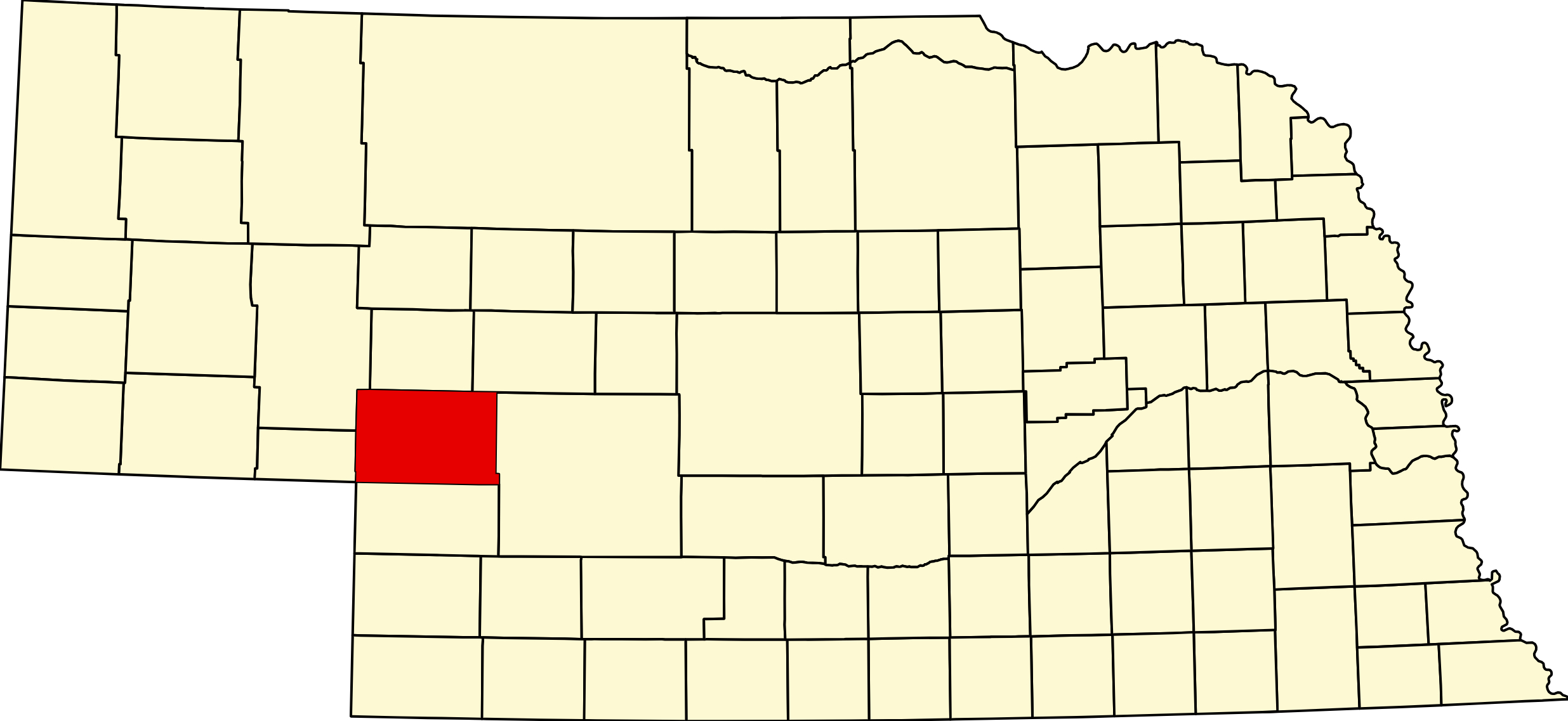
Keith County, Nebraska
County seat: Ogallala · Created: February 27, 1873; organized May 3, 1873 · Named for: M. C. Keith, North Platte rancher · License plates: prefix 68 · Population: 8,335 (2020 census); peak 9,364 in 1980 · Area: 1,110 sq mi · Time zone: Mountain
About Keith County
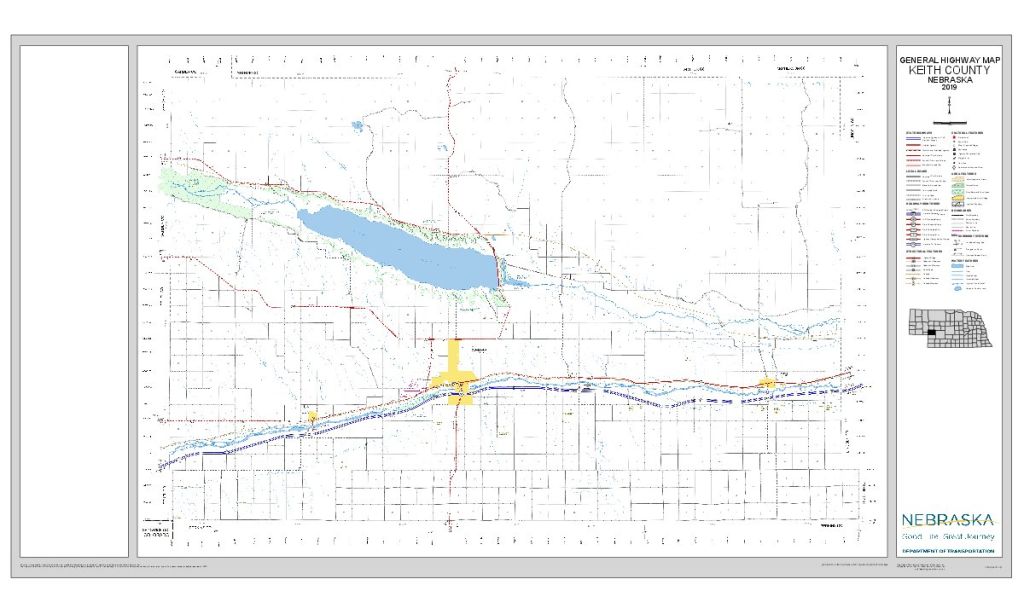
Keith County lies where the North and South Platte rivers run side by side across western Nebraska, with the Sandhills to the north and wheat country to the south. Lake McConaughy, Nebraska's largest reservoir, fills the North Platte valley behind Kingsley Dam. The Oregon, California and Mormon trails followed the two rivers: emigrants forded the South Platte at the Lower California Crossing and climbed California Hill west of Brule, and the Pony Express kept stations at Alkali, Sand Hill and Diamond Springs in 1860–61. The Union Pacific built up the South Platte in 1867. The Legislature created the county on February 27, 1873, and it was organized on May 3, 1873, at Louis Aufdengarten's house in Ogallala; it is named for M. C. Keith, a North Platte rancher whose grandson Keith Neville became governor (some sources mention a John Keith). Voters split off the southern part as Perkins County in 1887.
From about 1875 to 1884 Ogallala was the northern end of the Texas cattle trail, where herds met the railroad. In 1906–09 the Union Pacific built its North Platte Valley branch past Keystone and Lemoyne. Kingsley Dam, a New Deal project built in 1936–41 and among the largest hydraulic-fill dams of its time, created Lake McConaughy and forced Lemoyne to move uphill. Interstate 80 arrived in the late 1960s, and the county's population peaked at 9,364 in 1980. In March 2026 the Morrill Fire, the largest recorded wildfire in Nebraska (about 642,000 acres), burned south to the lake's north shore and forced Lemoyne's evacuation, and by late summer drought had dropped Lake McConaughy below 30 percent of capacity, closing its public boat ramps.
Towns of Keith County
Cities and villages
Ogallala
The Keith County seat, a city of 4,878 on I-80 and the South Platte, and the northern end of the Texas cattle trail in 1875–84. Front Street, Boot Hill and the Mansion on the Hill, with Kingsley Dam and Lake McConaughy 7 mi north.
Paxton
Village of 516 on US 30 and the Union Pacific near I-80 exit 145, first the siding of Alkali and renamed in 1885 for cattleman William A. Paxton. Ole's Big Game Steakhouse and its trophy collection have drawn travelers since 1933.
Brule
Village of 331 on US 30 and the Union Pacific at I-80 exit 117, laid out in 1886 and named for the Brulé Lakota. Gateway to the Oregon Trail ruts on California Hill and to the south shore of Lake McConaughy.
Keystone
Hamlet of 73 below Kingsley Dam, platted in 1906 on William A. Paxton's land and named for his Keystone cattle brand. Its 1908 Little Church has a Catholic altar at one end and a Protestant lectern at the other.
Lemoyne
North-shore hamlet of 44 on NE 92, moved uphill in 1937–41 when Lake McConaughy flooded the original town; the old foundations reappeared in 2004 and again in 2026. Big Mac Marina, Stetson's and lake cabins.
Roscoe
Union Pacific siding of 1868 on US 30, 7 mi east of Ogallala, with a store and post office from 1909. The site of Alkali, an Overland stage and Pony Express station of 1859–67, is 3½ mi east.
Former towns and post office communities
Alkali Station
Overland stage station of 1859–67 on the South Platte east of Roscoe, a Pony Express stop in 1860–61 and a fortified army post during the Civil War. National Register 2016; marker on US 30.
Belmar
Lakeshore community of 199 on the north side of Lake McConaughy, west of Lemoyne; a Union Pacific village with a post office from 1910 to 1941.
Sarben
Hamlet of 31 in the North Platte valley northeast of Paxton, named from "Aksarben," Nebraska spelled backward.
Martin
Hamlet of 76 where NE 61 meets NE 92, north of Kingsley Dam, near the Martin Bay campground on Lake McConaughy; once a Union Pacific flag stop.
Travel Corridors
I-80 — along the South Platte, with exits at Brule (117), Ogallala (126), Roscoe (133) and Paxton (145). I-80 Corridor →
US 30 — the Lincoln Highway, through Brule, Ogallala, Roscoe and Paxton. US 30 Corridor →
NE 92 — along the north shore of Lake McConaughy from Lewellen through Lemoyne to NE 61 at Martin, and on to Arthur. NE 92 Corridor →
Other highways — US 26 begins at I-80 in Ogallala and runs northwest to Ash Hollow and Scottsbluff; NE 61 runs from Grant north through Ogallala, across Kingsley Dam, to Arthur.
Cameras: View Keith County cameras → · Road conditions: Nebraska 511
Things to See
In Ogallala, Front Street, Boot Hill, the 1887 Mansion on the Hill and the 1938 post office mural Long Horns. Near Brule, the Oregon Trail ruts on California Hill and the Diamond Springs stage station site; east of Roscoe, the Alkali Station marker. In Keystone, the 1908 Little Church, shared by Catholics and Protestants. North of Ogallala, Kingsley Dam and the Lake McConaughy Visitor and Water Interpretive Center. The county has 14 National Register listings, the newest the Up/Over sculpture at the I-80 rest area near Roscoe (2026).
Outdoors
Lake McConaughy, about 22 miles long, is known for its white sand beaches, walleye and wipers, and camping: seven campgrounds and more than 950 beach sites, with its own day-of-week fee schedule. Below the dam, Lake Ogallala has trout fishing and winter eagle viewing. In 2026 the lake was below 30 percent of capacity and all public boat ramps were closed; check with Game and Parks, (308) 284-8800, before you go. The Ogallala Strip WMA follows the South Platte west of Ogallala. Golf: Crandall Creek in Ogallala and Bayside on the south shore.
Keith County Business Directory
Businesses within 20 miles of: Ogallala · Paxton · Brule · Lemoyne · All listings →
Adjacent Counties
Arthur County (north) · McPherson County (northeast, on Central Time) · Lincoln County (east, on Central Time) · Perkins County (south) · Deuel County (west) · Garden County (northwest); Sedgwick County, Colorado, touches only at the southwest corner.
Events
2026 dates: the Ogallala Round-Up Rodeo, July 25–26; the Keith County Fair in Ogallala, July 29–August 1; Brule Day, August 1; the Paxton Labor Day Celebration, September 5–7; the Indian Summer Rendezvous in Ogallala, September 17–19; the Keith County Holiday Craft Fair, November 21; and the Christmas Parade of Lights in Ogallala, December 3.
Events in Keith County
- Keith County Fair (Ogallala)
County fair in Ogallala, July 29–August 1, 2026, with parade, 4-H shows, livestock sale and combine derby.
Know of another event in the county? Tell us about it.
Keith County at a Glance
Keith County, Nebraska — the two Platte rivers, Lake McConaughy and Ogallala, the old end of the Texas cattle trail. County seat Ogallala; Mountain Time.
Getting there: I-80 and US 30 along the South Platte; US 26 from Scottsbluff; NE 61 from Grant and Arthur; NE 92 along the north shore.
For visitors: Lake McConaughy and Kingsley Dam, Front Street and Boot Hill in Ogallala, California Hill near Brule, the Little Church at Keystone and Ole's in Paxton. Hospital: Ogallala Community Hospital.
Vehicles registered in Keith County carry license plate number 68. See what every Nebraska county number means.
Keith County Businesses & Places
168 listings in Keith County.
Click a category to see the businesses.
Eat & Drink (18)
- Bollywood Indian Kitchen — Indian Restaurant, Nebraska
- Burger King Ogallala — Burger King, Nebraska
- Dairy Queen Ogallala — Dairy Queen, Nebraska
- Driftwood — American Restaurant, Nebraska
- Front Street Steakhouse & Crystal Palace Saloon — Steakhouse, Nebraska
- Golden Village — Chinese Restaurant, Nebraska
- Hardee's Ogallala — Hardee's, Nebraska
- Hooks Lake Bar and Grill — Bar & Grill, Brule
- McDonald's - Ogallala (301 Stagecoach Trl) — McDonald's, Nebraska
- Ole's Big Game Steakhouse & Lounge — Bar & Grill, Nebraska
- Open Range Grill — American Restaurant, Nebraska
- Runza Restaurant — Restaurant, Nebraska
- Second Chapter Brewing — Brewery & Taproom, Nebraska
- Subway – I 80 & Highway 61, Ogallala — Subway, Nebraska
- Taco Bell Ogallala E 1st St — Mexican Restaurant, Nebraska
- Taco Bell Ogallala Oregon Trail — Mexican Restaurant, Nebraska
- Taco John's – Ogallala — Restaurant, Nebraska
- Wendys Ogallala — Wendy's, Nebraska
Stay (6)
- Best Western Plus Ogallala Inn — Hotel, Nebraska
- Comfort Inn & Suites - Ogallala — Hotel, Nebraska
- Days Inn Paxton — Hotel, Nebraska
- Hampton Inn - Ogallala — Hotel, Nebraska
- Vogl's Lodge & Lure — Hotel, Lemoyne
- West Road RV Plaza — RV Park, Brule
Outdoors & Recreation (19)
- Bayside Golf Club — Golf Course, Brule
- Big Mac Campground LLC — Campgrounds & RV Parks, Lemoyne
- Big Mac Marina — Boat Ramps & Marinas, Lemoyne
- Clear Creek WMA — Public Hunting Areas & WMAs, Nebraska
- Cottonwood Grove — Campgrounds & RV Parks, Nebraska
- Country View Campground — Campgrounds & RV Parks, Nebraska
- Crandall Creek Golf Club — Golf Course, Nebraska
- Eagle Canyon Hideaway — Campgrounds & RV Parks, Brule
- Lake Mac RV Rentals -Lake McConaughy, Lake Ogallala — Campgrounds & RV Parks, Lemoyne
- Lake McConaughy State Recreation Area — Campgrounds & RV Parks, Nebraska
- Lake Ogallala State Recreation Area — Campgrounds & RV Parks, Keystone
- Ogallala KOA — Campgrounds & RV Parks, Nebraska
- Ogallala Optimist Disc Golf Course — Disc Golf Course, Nebraska
- Ogallala Strip WMA — Public Hunting Areas & WMAs, Nebraska
- Prairie View RV Park — Campgrounds & RV Parks, Lemoyne
- Riverside Campground — Campgrounds & RV Parks, Brule
- Stetson's — Bait & Tackle, Lemoyne
- Swede’s Pond Disc Golf Course — Disc Golf Course, Nebraska
- Van's Lakeview Fishing Camp — Campgrounds & RV Parks, Brule
Places to Visit (11)
- Alkali Station Historical Marker — Historic Marker, Nebraska
- California Hill (Oregon Trail Ruts) — Historic Marker, Brule
- Diamond Springs Stage Station Site — Attraction, Brule
- Front Street and Cowboy Museum — Specialty Museums, Nebraska
- Keith County Historical Society, Mansion on the Hill — History & Heritage Museums, Nebraska
- Kingsley Dam — Attraction, Nebraska
- Lake Ogallala State Recreation Area — RV Camping, Keystone
- Petrified Wood & Art Gallery — Science & Nature Museums, Nebraska
- Standard Oil Red Crown Service Station — Attraction, Nebraska
- The Little Church at Keystone (Keystone Community Church) — Specialty Museums, Keystone
- Tri-Trails Park Historical Markers — Historic Marker, Nebraska
Events & Venues (3)
- Keith County Fair — County Fair, Nebraska
- Keith County Fairgrounds — Fairground, Nebraska
- Ogallala Swimming Pool — Swimming Pool, Nebraska
Health & Emergency (4)
- Animal Clinic and Pharmacy - Ogallala — Veterinarian, Nebraska
- Ogallala Community Hospital — Hospital, Nebraska
- Perkins County Family Clinic — Medical Clinic, Nebraska
- Touch of Class Massage — Massage, Nebraska
Travel Services (4)
- Kent's Towing and Repair — Towing Services, Nebraska
- Ogallala Rest Area Eastbound — Rest Areas & Travel Plazas, Nebraska
- Ogallala Rest Area Westbound — Rest Areas & Travel Plazas, Nebraska
- TA Travel Center — Ogallala — Truck Stop, Nebraska
Shopping & Gifts (4)
- Doris Wiest Hardware — Hardware Store, Brule
- Hehnke's Foods — Grocery, Nebraska
- Safeway - Ogallala — Grocery, Nebraska
- Walmart Supercenter - Ogallala — Department store, Nebraska
Government & Resources (31)
- ACCESSNebraska Office - Ogallala — Developmental & Social Services, Nebraska
- Arthur-Keith Veterans Service Office — Veterans Office, Nebraska
- Brule Post Office — Post Office, Brule
- Brule Village Office — City Hall, Brule
- Brule Volunteer Fire Hall — Fire Station, Brule
- Kathleen Lute Public Library — Libraries, Nebraska
- Keith County Assessor — County Assessor, Nebraska
- Keith County Attorney's Office — County Attorney, Nebraska
- Keith County Clerk — County Clerk, Nebraska
- Keith County Court — County Court, Nebraska
- Keith County Courthouse — Court House, Nebraska
- Keith County Driver License Office — County Driver License, Nebraska
- Keith County Emergency Management — Emergency Management, Nebraska
- Keith County Senior Center — Senior Citizen Center, Nebraska
- Keith County Sheriff — County Sheriff, Nebraska
- Keith County Treasurer — County Treasurer, Nebraska
- Keith County Weed Superintendent — County Weed Control, Nebraska
- Keith-Arthur County Food Pantry — Food Pantry, Nebraska
- Lemoyne Senior Center — Senior Citizen Center, Lemoyne
- Ogallala Fire Department — Fire Station, Nebraska
- Ogallala Keith County Chamber of Commerce — Chamber of Commerce, Nebraska
- Ogallala Police Department — Police Station, Nebraska
- Ogallala Post Office — Post Office, Nebraska
- Ogallala USDA Service Center — USDA Service Center (FSA/NRCS), Nebraska
- Paxton Fire Department — Fire Station, Nebraska
- Paxton Post Office — Post Office, Nebraska
- Paxton Public Library — Libraries, Nebraska
- Paxton Senior Meal Site (Ole's Big Game Steakhouse) — Senior Citizen Center, Nebraska
- Paxton Village Office — City Hall, Nebraska
- West Central Nebraska Development District (WCNDD) — Economic development agency, Nebraska
- West Central Nebraska Joint Housing Authority — Housing Authority, Nebraska
Community & Faith (28)
- Amateur Radio Repeaters - Keith County (via RepeaterBook.com) — Amateur Radio Repeater, Nebraska
- Apostolic Family Worship Center — Pentecostal, Nebraska
- Boot Hill Cemetery — Cemeteries, Nebraska
- Brule Cemetery — Brule — Cemeteries, Brule
- Congregational Church — Brule — Congregational Church, Brule
- First Congregational UCC — Ogallala — Congregational Church, Nebraska
- Glen Echo Church Cemetery — Paxton — Cemeteries, Nebraska
- Kingdom Hall of Jehovah's Witnesses — Jehovah’s Witnesses Church, Nebraska
- Lemoyne Cemetery — Lemoyne — Cemeteries, Lemoyne
- New Hope Church — Evangelical Free Church, Nebraska
- New Life - Ogallala — Pentecostal, Nebraska
- Ogallala Cemetery — Ogallala — Cemeteries, Nebraska
- Ogallala Church of Christ — Other Denomination, Nebraska
- Ogallala First UMC — Methodist Church, Nebraska
- Ogallala Seventh-day Adventist Church — Seventh-day Adventist Church, Nebraska
- Paxton Cemetery — Paxton — Cemeteries, Nebraska
- Paxton Mennonite Church Cemetery — Paxton — Cemeteries, Nebraska
- Paxton UMC — Methodist Church, Nebraska
- Pickard Cemetery — Keystone — Cemeteries, Keystone
- Saint John’s Lutheran Church Cemetery — Ogallala — Cemeteries, Nebraska
- St. John Lutheran Church — Lutheran Church, Brule
- St. John Lutheran Church — Lutheran Church, Nebraska
- St. Luke Catholic Church Ogallala — Catholic Church, Nebraska
- St. Patrick Paxton — Catholic Church, Nebraska
- St. Paul Lutheran Church — Lutheran Church, Nebraska
- St. Paul's Episcopal Church — Episcopal Church, Nebraska
- Trinity Lutheran Church — Lutheran Church, Nebraska
- Trinity Lutheran Church — Lutheran Church, Nebraska
Automotive (10)
- Casey's General Store - Ogallala — Casey's, Nebraska
- Cody's Auto Repair — Auto Repair, Brule
- Duke's Autobody & Paint — Auto Body Repair, Brule
- Eichner Sales and Service — Motor Sports, Nebraska
- Hammer Lane Truck Sales — Truck Dealership, Nebraska
- Kent's Towing and Repair — Auto Repair, Nebraska
- Poppe's Truck & Diesel Repair — Auto Repair, Nebraska
- Pump & Pantry - Ogallala — Pump & Pantry, Nebraska
- Wolf Auto Ogallala — Franchised New Car Dealer, Nebraska
- Wolf Chevrolet GMC of Ogallala — Franchised New Car Dealer, Nebraska
Education (9)
- Keith-Arthur County Extension — County Extension Office, Nebraska
- Ogallala High School — High School, Nebraska
- Ogallala Middle School — Elementary & Middle School, Nebraska
- Ogallala Public Schools — School District (K-12 / General), Nebraska
- Paxton Consolidated Schools — School District (K-12 / General), Nebraska
- Paxton Elementary School — Elementary & Middle School, Nebraska
- Paxton High School — High School, Nebraska
- Prairie View School — Elementary & Middle School, Nebraska
- Tiny Trails Early Learning Center — Elementary & Middle School, Nebraska
Professional Services (7)
- Adams Bank & Trust - Brule — Banking, Brule
- Adams Bank & Trust - Ogallala — Banking, Nebraska
- Dana F. Cole & Company - Ogallala — Accountant, Nebraska
- Edgewater Insurance – Ogallala — Insurance, Nebraska
- Pinnacle Bank - Ogallala — Banking, Nebraska
- Sandhills State Bank - Ogallala — Banking, Nebraska
- Western Nebraska Bank – Paxton — Banking, Nebraska
Media (7)
- K26CV-D Channel 26 - Ogallala — TV Station, Nebraska
- Keith County News — News Paper, Nebraska
- KGWO 89.5 FM - Ogallala — Radio Station, Nebraska
- KMCX 106.5 FM - Ogallala — Radio Station, Nebraska
- KOGA 930 AM and 99.7 FM - Ogallala — Radio Station, Nebraska
- KQQO-LP 97.7 FM - Ogallala — Radio Station, Nebraska
- Spirit Catholic Radio 90.5 FM - Ogallala — Spirit Catholic Radio, Nebraska
Agriculture & Farm (6)
- 21st Century Equipment - Ogallala — Equipment Dealers, Nebraska
- Animal Clinic and Pharmacy - Ogallala — Equine Veterinarian, Nebraska
- Bomgaars – Ogallala — Bomgaars, Nebraska
- Hi-Line Co-op — Farm Coop, Brule
- J C Miller Saddlery — Tack & Saddlery, Nebraska
- Jump Rope Stables — Boarding Stable, Nebraska
Utilities (2)
- City of Ogallala — Water Utility / District, Nebraska
- Village of Brule — Water Utility / District, Brule
Transportation (2)
- City of Ogallala Transit — Public Transportation, Nebraska
- Searle Field — Ogallala — Municipal / General Aviation Airport, Nebraska