
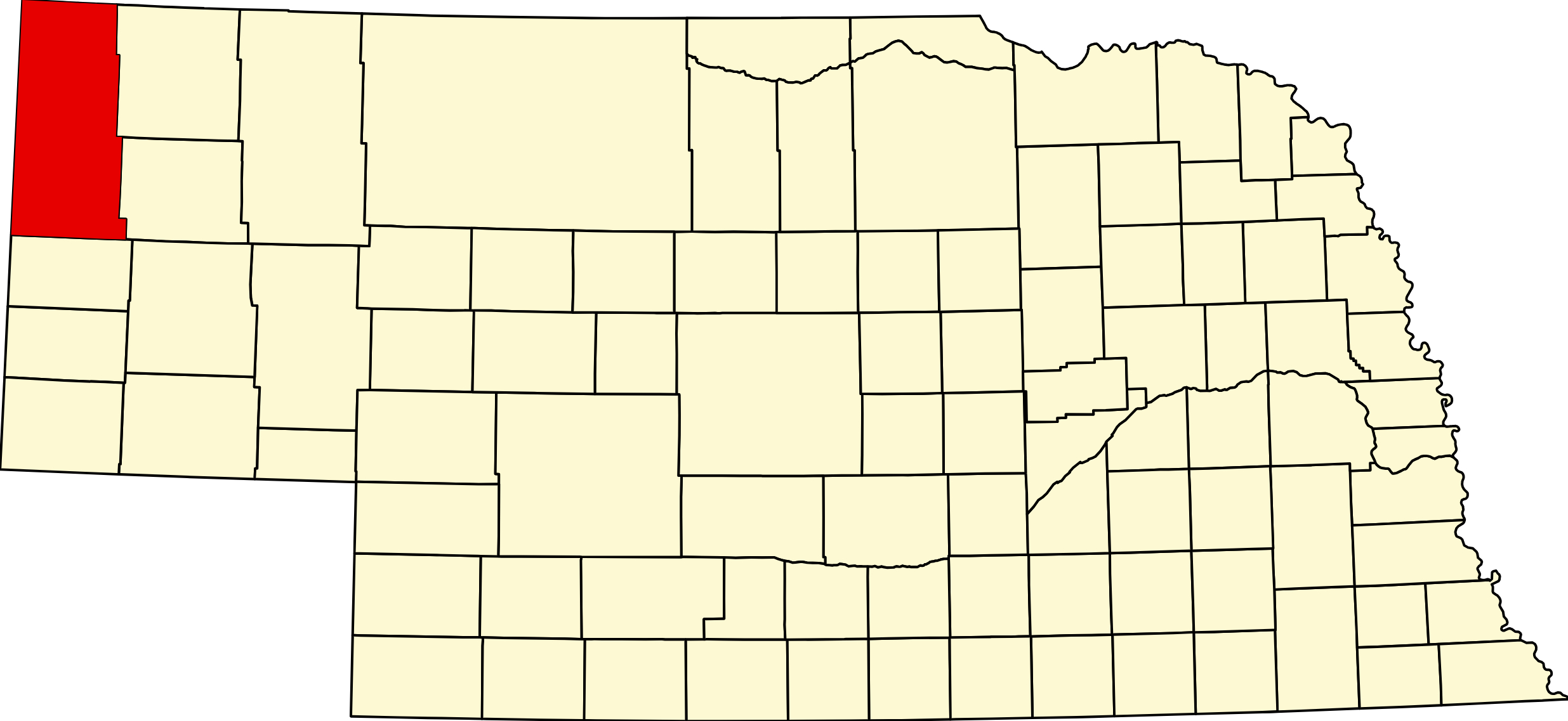
Sioux County, Nebraska
County seat: Harrison · Created: February 19, 1877; organized 1886 · Named for: the Sioux (Lakota) people · License plates: prefix 80 · Population: 1,135 (2020 census); peak 5,599 in 1910 · Area: 2,067 sq mi · Time zone: Mountain
About Sioux County
Sioux County is Nebraska's northwestern corner, one of the largest and least populated counties in the state, bordering Wyoming and South Dakota. The Pine Ridge escarpment crosses it near Harrison, its only town; to the north lie the badlands and grasslands of the Oglala National Grassland, and to the south the Niobrara River and the fossil hills at Agate. On July 17, 1876, the 5th Cavalry and Buffalo Bill Cody fought the Cheyenne at Warbonnet Creek near today's Montrose.
The legislature created the county on February 19, 1877, and it was organized in 1886, after Dawes County was carved from it. The Fremont, Elkhorn & Missouri Valley Railroad, later the Chicago & North Western, built across the county in 1886, and from Coffee Siding and Harrison ranchers shipped cattle east; Bowen, renamed Harrison in 1887, won the county seat over Bodarc, Andrews and Montrose. The Burlington crossed the northeast corner in 1889 through Joder and Orella. Kinkaid homesteaders brought the population to 5,599 in 1910; it has fallen to about 1,100 today. Agate Fossil Beds and the Hudson-Meng bison bonebed are among the county's seven National Register listings.
Towns of Sioux County
Cities and villages
Harrison
The Sioux County seat and the county's only town, 239 people at about 4,876 feet, billed as Nebraska's highest town, on US 20 near the Wyoming line. The 1930 courthouse, a historical museum complex and the road south to Agate Fossil Beds.
Former towns and post office communities
Agate
Ranch post office (1899–1968) at the Niobrara crossing of NE 29, named for James H. Cook's Agate Springs Ranch, now the home of Agate Fossil Beds National Monument.
Andrews
Former station on the Chicago & North Western "Cowboy Line" in the upper White River valley east of Harrison, with a post office from 1906 to 1951.
Montrose
Settlement of 1887 on Hat Creek in northern Sioux County, now in the Oglala National Grassland, with its 1887 Immaculate Conception church and the monuments of the 1876 Battle of Warbonnet Creek.
Coffee Siding
Cattle-loading siding of 1886 on the railroad just inside Nebraska west of Harrison, built by rancher Charles F. Coffee to avoid Wyoming freight rates; a state marker stands on US 20.
Glen
Pine Ridge community with a post office from 1887 to 1953 and a one-room school that taught for 120 years, about 10 miles west-southwest of Crawford.
Joder
Former Burlington siding on Cottonwood Creek north of Crawford, first called Adelia, near Toadstool Geologic Park and the Hudson-Meng bison bonebed.
Orella
Burlington railroad town of 1906 north of Crawford, abandoned in 1968; its depot and houses survive on private land with no public access.
Story
Rural post office (1891–1935) in the far northwestern corner of Nebraska, named for postmaster Solomon R. Story.
Bodarc
Hat Creek settlement of the 1880s northeast of Harrison, home of the county's first newspaper and Harrison's main rival for the county seat in 1887; its church and cemetery remain.
Travel Corridors
US 20 — the Bridges to Buttes Byway, from Lusk, Wyoming, through Harrison and across the Pine Ridge to Fort Robinson and Crawford. US 20 Corridor →
NE 29 — south from Harrison past Agate Fossil Beds to Mitchell and US 26, about 56 miles. NE 71 crosses the southeastern corner between Scottsbluff and Hemingford.
Cameras: View Sioux County cameras → · Road conditions: Nebraska 511
Things to See
Agate Fossil Beds National Monument, with its 20-million-year-old fossil hills, Daemonelix burrows and the Cook Collection of Lakota gifts (no fee); Toadstool Geologic Park and the Hudson-Meng bison bonebed in the Oglala National Grassland north of Crawford; the Warbonnet battlefield and the 1887 church at Montrose; and in Harrison the 1930 courthouse and the Sioux County Historical Museum. State markers stand at Coffee Siding on US 20 and, near Fort Robinson, for the Cheyenne Outbreak of 1879.
Outdoors
The Oglala National Grassland covers about 94,500 acres in the north of the county and western Dawes County; Toadstool has 12 campsites. Wildlife areas open to hunting: Gilbert-Baker (about 2,535 acres, north of Harrison, free primitive camping), Peterson (4,261 acres, on US 20 west of Fort Robinson) and Fort Robinson WMA. Part of Fort Robinson State Park and the Soldier Creek Wilderness lie in the county. In Harrison, Harrison City Park has free RV pads.
Sioux County Business Directory
Businesses within 20 miles of: Harrison · All listings →
Adjacent Counties
Fall River County, South Dakota (north) · Dawes County (east) · Box Butte County (southeast) · Scotts Bluff County (south) · Goshen County, Wyoming (southwest) · Niobrara County, Wyoming (west).
Events
Each year: the Sioux County Fair in Harrison in late July and early August, with rodeos, a parade and a demolition derby; Hudson-Meng tours on summer Fridays; and a September Mass at the 1887 church in Montrose.
Events in Sioux County
- Sioux County Fair (Harrison)
Sioux County Fair, a county fair in Harrison, Nebraska.
Know of another event in the county? Tell us about it.
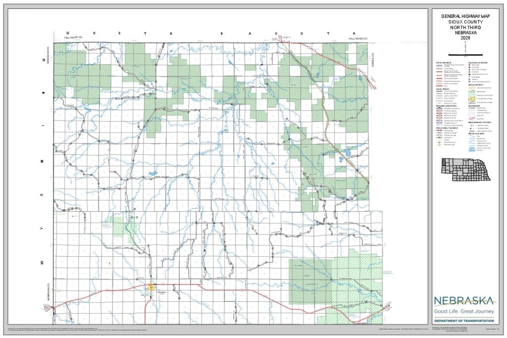
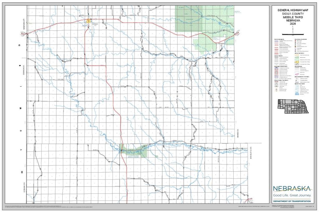
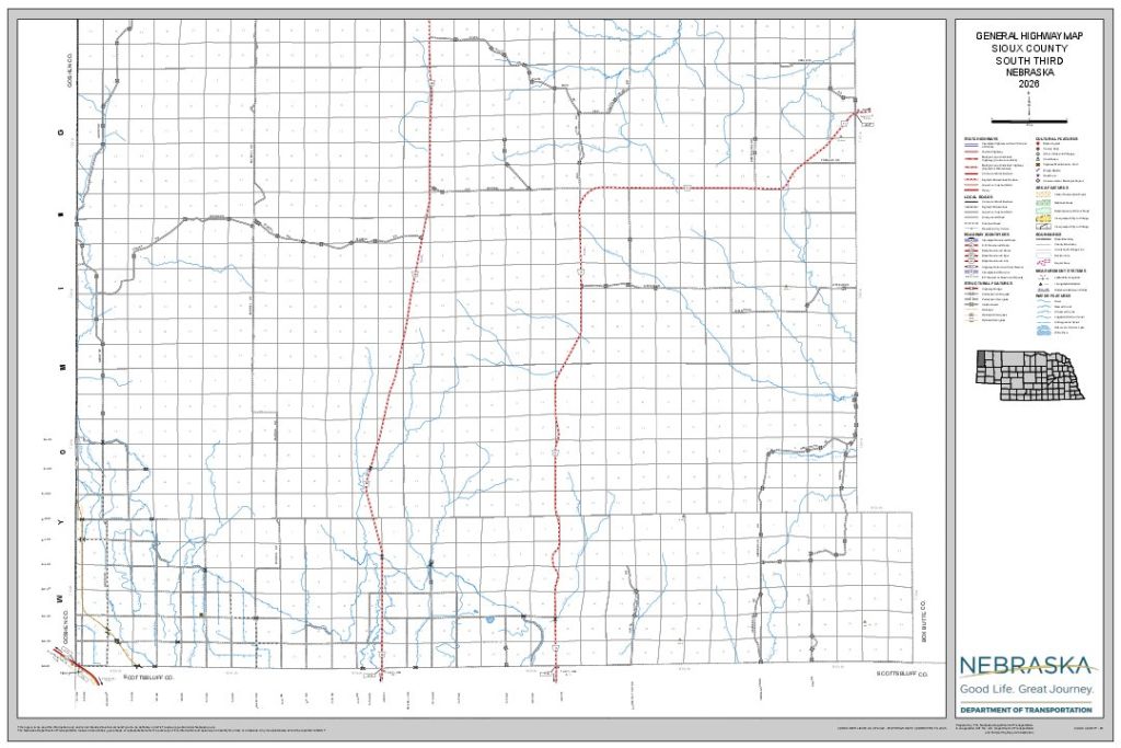
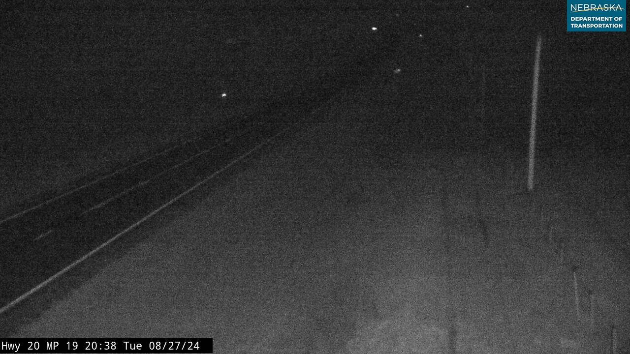
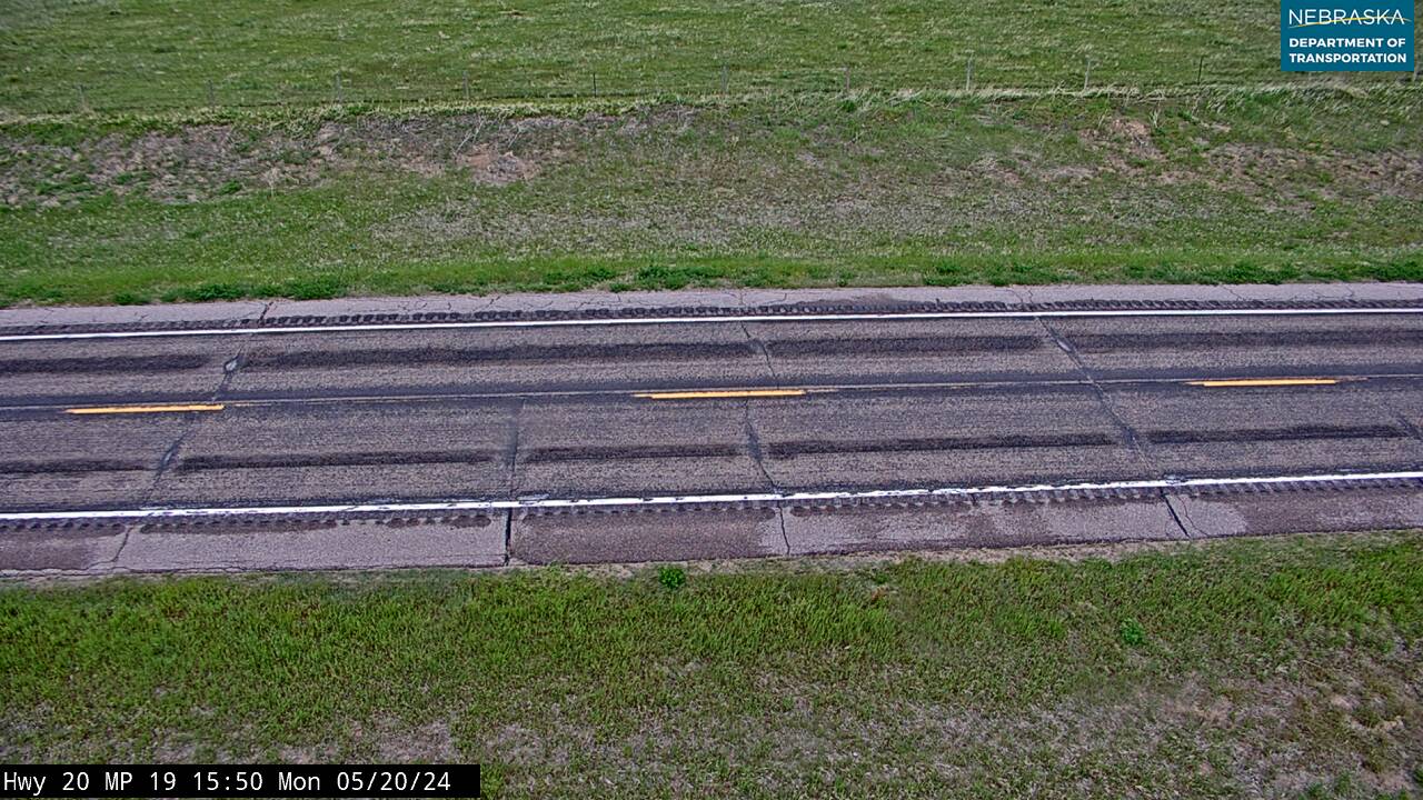
Sioux County at a Glance
Sioux County, Nebraska — the state's northwestern corner, on the Wyoming and South Dakota lines. County seat Harrison, the only town; Mountain Time.
Getting there: US 20 from Lusk, Wyoming, or Crawford; NE 29 from Mitchell.
For visitors: Agate Fossil Beds, Toadstool Geologic Park, Hudson-Meng and the Warbonnet battlefield. No hospital: Lusk, Wyoming, or Chadron. Fuel and food are scarce; plan ahead.
Vehicles registered in Sioux County carry license plate number 80. See what every Nebraska county number means.
Sioux County Businesses & Places
66 listings in Sioux County.
Click a category to see the businesses.
Eat & Drink (1)
- Longhorn Saloon & Grill — Bar & Grill, Harrison
Outdoors & Recreation (9)
- Agate Fossil Beds National Monument — National Parks & Monuments, Agate
- Fort Robinson WMA — Public Hunting Areas & WMAs, Glen
- Gilbert-Baker WMA — Campgrounds & RV Parks, Harrison
- Harrison City Park — Campgrounds & RV Parks, Harrison
- Oglala National Grassland - Harrison — National Parks & Monuments, Harrison
- Peterson WMA — Public Hunting Areas & WMAs, Glen
- Sage Motel & Campground — Campgrounds & RV Parks, Harrison
- Soldier Creek Campground — Campgrounds & RV Parks, Glen
- Toadstool Geologic Park and Campground — National Parks & Monuments, Joder
Places to Visit (9)
- Battle of Warbonnet Creek Monument — Historic Marker, Montrose
- Coffee Siding — Historic Marker, Coffee Siding
- Fort Laramie - Fort Robinson Trail Historical Marker — Historic Marker, Harrison
- Harrison City Park — City Parks, Harrison
- Hudson-Meng Education and Research Center — History & Heritage Museums, Joder
- Scenic Overlook near Harrison NE — Natural Sites, Harrison
- Sioux County Historical Museum — History & Heritage Museums, Harrison
- The Cheyenne Outbreak — Historic Marker, Glen
- Village of Harrison Historical Marker — Historic Marker, Harrison
Events & Venues (3)
- Harrison Swann Community Site — Community Center, Harrison
- Sioux County Fair — County Fair, Harrison
- Sioux County Fairgrounds — Fairground, Harrison
Shopping & Gifts (1)
- Harrison Market — Grocery, Harrison
Community & Faith (19)
- Andrews Cemetery — Andrews — Cemeteries, Andrews
- Bannan Family Cemetery — Harrison — Cemeteries, Harrison
- Bodarc Cemetery — Cemeteries, Bodarc
- Church of the Nativity of the Blessed Virgin Mary Harrison — Catholic Church, Harrison
- Coliseum Butte Cemetery — Harrison — Cemeteries, Harrison
- Cook Gravesite — Agate — Cemeteries, Agate
- Glendale Cemetery — Cemeteries, Glen
- Harrison Bible Church — Non-Denominational Church, Harrison
- Harrison Cemetery — Harrison — Cemeteries, Harrison
- Harrison Memorial UMC — Methodist Church, Harrison
- Immaculate Conception Church (Montrose) — Catholic Church, Montrose
- Mason Family Cemetery — Glen — Cemeteries, Glen
- Montrose Cemetery — Montrose — Cemeteries, Montrose
- Pioneer Cemetery — Sioux County — Cemeteries, Montrose
- Saint Mary Cemetery — Harrison — Cemeteries, Harrison
- Scandinavian Lutheran Cemetery — Glen — Cemeteries, Glen
- Sheep Creek Presbyterian Church Cemetery — Cemeteries, Nebraska
- Union Star Cemetery — Cemeteries, Joder
- Unit Cemetery — Cemeteries, Glen
Government & Resources (14)
- Harrison Post Office — Post Office, Harrison
- Harrison Volunteer Fire Department — Fire Station, Harrison
- Sioux County Assessor — County Assessor, Harrison
- Sioux County Attorney's Office — County Attorney, Harrison
- Sioux County Clerk — County Clerk, Harrison
- Sioux County Court — County Court, Harrison
- Sioux County Courthouse — Court House, Harrison
- Sioux County Driver License Office — County Driver License, Harrison
- Sioux County Public Library - Harrison — Libraries, Harrison
- Sioux County Sheriff — County Sheriff, Harrison
- Sioux County Treasurer — County Treasurer, Harrison
- Sioux County Veterans Service Office — Veterans Office, Harrison
- Sioux County Weed Superintendent — County Weed Control, Harrison
- Sunshine Senior Center - Harrison — Senior Citizen Center, Harrison
Education (6)
- Chalk Butte School — Elementary & Middle School, Harrison
- Harrison Grade School — Elementary & Middle School, Harrison
- Pink School — Elementary & Middle School, Harrison
- Sioux County Extension — County Extension Office, Harrison
- Sioux County High School — High School, Harrison
- Sioux County Public Schools — School District (K-12 / General), Harrison
Automotive (1)
- Hillside Service — Fuel & Gas Station, Harrison
Media (1)
- K08LN-D Channel 13 - Harrison — TV Translator, Harrison
Manufacturing & Industrial (1)
- Rudloff Trucking LLC — Trucking Company, Harrison
Utilities (1)
- Village of Harrison — Water Utility / District, Harrison
Agriculture & Farm (1)
- WESTCO – Harrison — Farm Coop, Harrison