
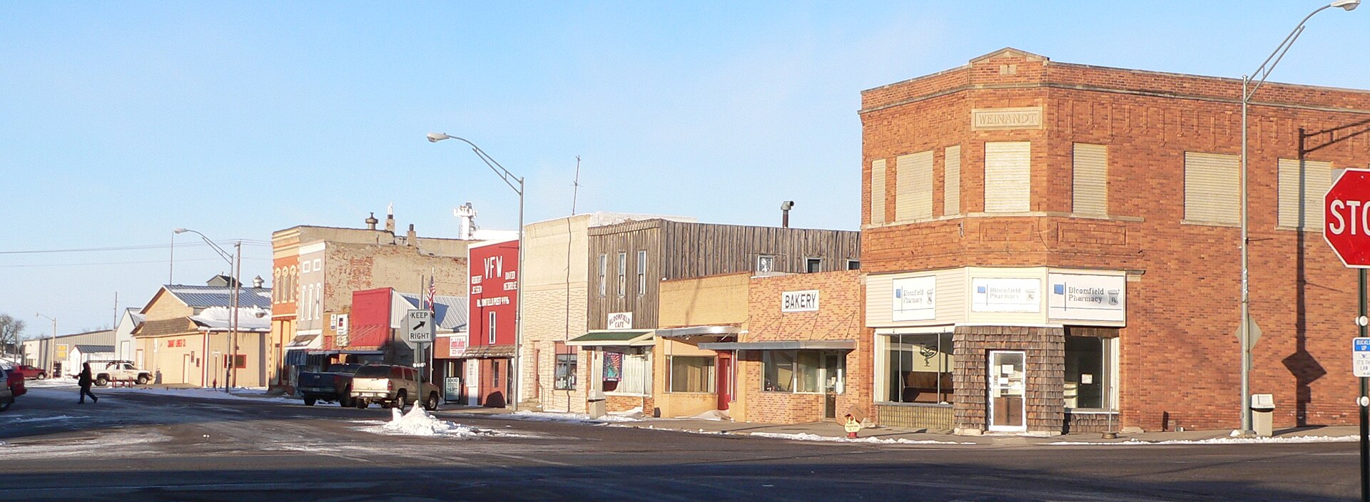
Listings in Bloomfield Nebraska
City · Knox County · Population 986 (2020 census) · ZIP 68718 · Founded 1890 · Peak population 1,467 (1940)
About Bloomfield
Bloomfield is a city of 986 on NE 84 in eastern Knox County, about 12 miles east of Center. It has Bloomfield Community Schools, a clinic and pharmacy, a motel, a public pool and Bloomfield City Park with a campground, and it hosts the Knox County Fair every August.
History
Bloomfield was founded in 1890, when the railroad arrived, and named for Bloomfield Dyer, the original owner of the town site. W. H. Harm's land company brought in many families from western Iowa and encouraged German settlement in the area. Harm also gave land for the city park and library, and with Ed H. Mason gave the city part of the high school campus and the land for the fairgrounds.
The population peaked at 1,467 in 1940. The Knox County Fair has been held in Bloomfield for generations; the 143rd fair ran August 12–16, 2026.
Highways and trails through Bloomfield
| Route | One way | Other way |
|---|---|---|
| NE 84Main Street through Bloomfield | West to Center (about 12 mi) and Verdigre (about 22 mi) | East to the NE 121 junction (about 6 mi) and Hartington (about 20 mi) |
Nearby towns
| Center | about 12 mi west | NE 84 |
| Wausa | about 12 mi southeast | NE 84 east, then NE 121 south |
| Lindy | about 10 mi north | Straight-line; county roads |
| Crofton | about 17 mi northeast | NE 84, NE 121 and county roads |
| Hartington | about 20 mi east | NE 84 |
| Creighton | about 21 mi southwest | NE 84 west, then NE 13 south |
Things to see
Bloomfield City Park, 604 S. Washington St., with a campground and the city pool · Knox County Fairgrounds · Bloomfield Historical Society · Bloomfield Public Library
Events in Bloomfield
- Knox County Fair
Knox County Fair is an annual county fair held in Bloomfield, Nebraska at the Knox County Fairgrounds, typically in mid-August.
More about this event: Knox County Fair
Know of another event here? Tell us about it.
Schools and health care
Schools: Bloomfield Community Schools: Bloomfield Elementary School (pre-K to grade 6), 514 S. McNamara St., and Bloomfield Jr-Sr High School, 311 E. Benton St.
Health care: Bloomfield Medical Clinic; Bloomfield Pharmacy, 105 S. Broadway; nearest hospitals Avera Creighton Hospital (about 21 mi) and Osmond General Hospital (about 23 mi)
Sources: U.S. Census; Wikipedia; History Nebraska; Andreas, History of the State of Nebraska (1882); Knox County; Nebraska Department of Transportation route mileposts. Distances marked "about" are estimates.
Bloomfield Nebraska
Bloomfield Nebraska
Bloomfield Nebraska
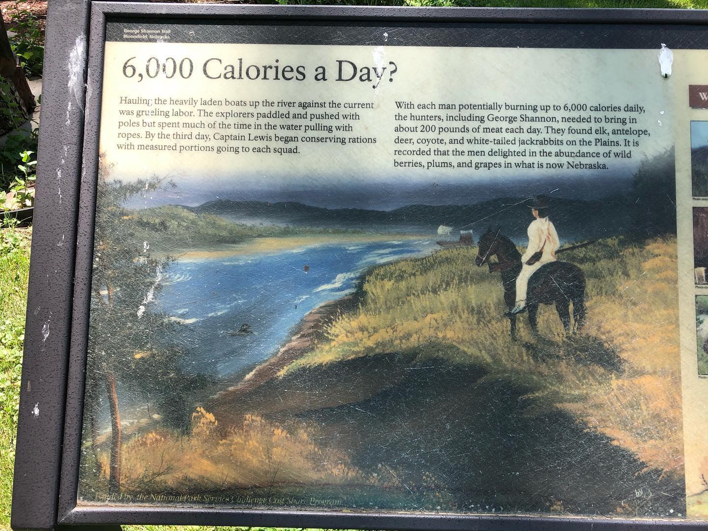
Bloomfield Nebraska
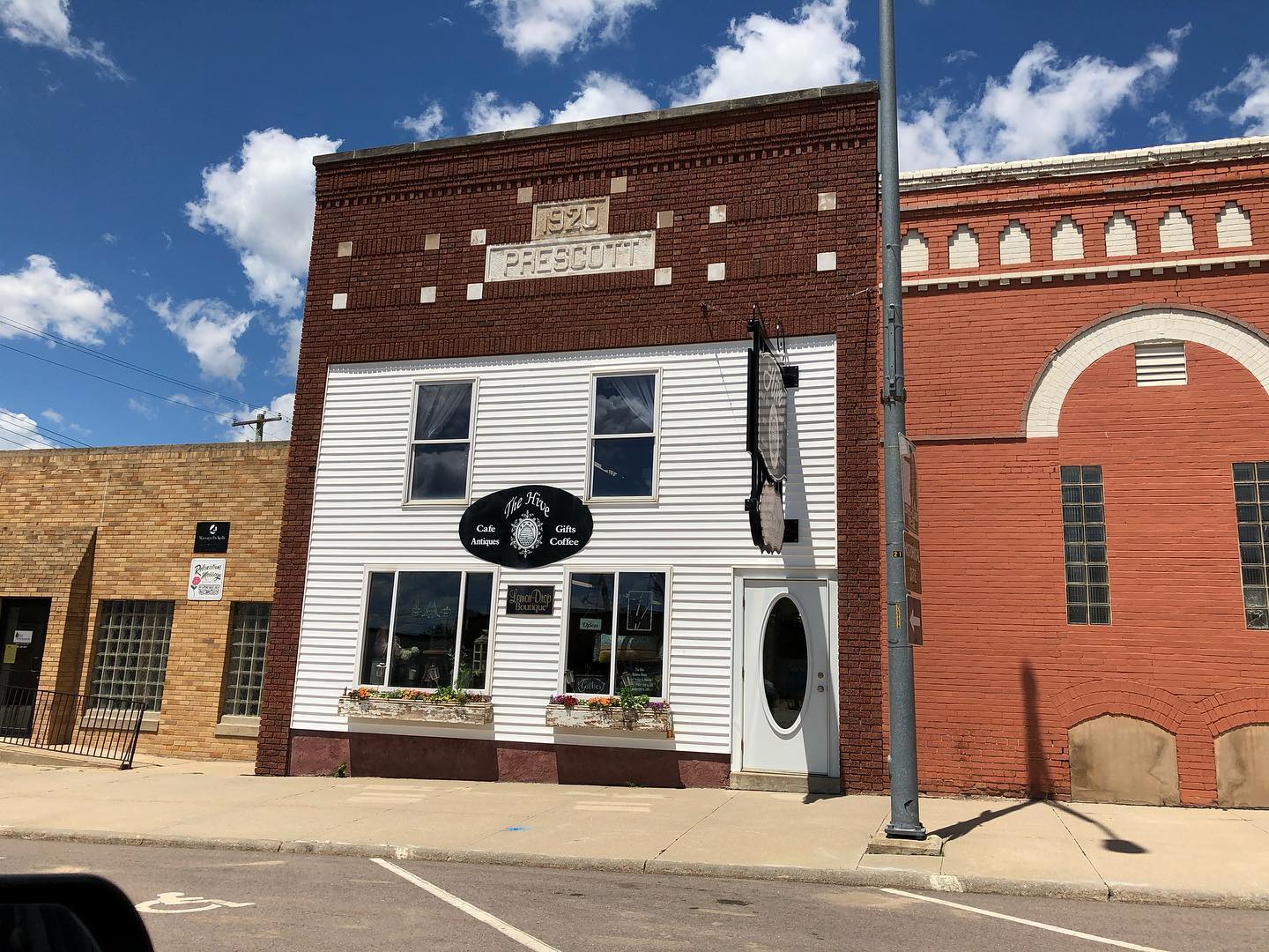
Bloomfield Nebraska

Bloomfield Nebraska
Navigate & Explore Bloomfield
Get directions to Bloomfield: Waze → · Google Maps → · Apple Maps →
Nearby businesses: Find businesses within 20 miles of Bloomfield →
Road conditions: Nebraska 511 — 511.nebraska.gov
Cameras: View Knox County cameras →
Travel corridor: NE 84 Corridor →
Bloomfield Businesses & Places
80 listings in Bloomfield.
Click a category to see the businesses.
Eat & Drink (5)
- Bloomfield Bakery — American Restaurant
- Bottom's Up — Bar & Grill
- Broadway Billies — American Restaurant
- The Hive — Cafe / Coffee Shop
- Time Out — Bar & Grill
Stay (1)
- Springs Motel — Motel
Outdoors & Recreation (3)
- Bloomfield City Park Campground — Campgrounds & RV Parks
- Glad Tidings Bible Camp Disc Golf Course — Disc Golf Course
- Knox County Fairgrounds — Campgrounds & RV Parks
Places to Visit (3)
- Bloomfield City Park — City Parks
- Bloomfield Historical Society — History & Heritage Museums
- Picnic Table Corner — Historic Marker
Events & Venues (4)
- Bloomfield City Swimming Pool — Swimming Pool
- Curts Lanes — Bowling Alley
- Knox County Fair — County Fair
- Knox County Fairgrounds — Fairground
Health & Emergency (7)
- Bloomfield Dental Clinic — Dentist & Dental Office
- Bloomfield Medical Clinic P.C. — Medical Clinic
- Bloomfield Pharmacy — Pharmacy
- Bloomfield Veterinary Clinic — Mixed / General Practice
- First Chiropractic Center — Chiropractor
- NextGen PT + Wellness — Physical Therapy
- Vision Care Associates — Optometrist
Shopping & Gifts (6)
- Blooms & Bling — Retail
- Country Market — Grocery
- Dollar General — Retail
- Farmers Pride COOP — Retail
- Hagge Glass — Glass & Mirror Shop
- Hefner Ace Hardware — Hardware Store
Agriculture & Farm (11)
- Bloom-N-Egg Farm — Poultry
- Central Valley Ag — Farm Coop
- Garry's Farm Service — Feed & Farm Supply Store
- Grossenburg Implement — Equipment Dealers
- Hefner Oil & Feed Co — Animal Feed Store
- Husker Pig Co-op — Grain Elevator / Cooperative
- Knox County Feeders Inc. — Livestock / Cattle Ranch
- Popcorn Paradise — Popcorn Producer
- Poppe Hay Company — Ag Consulting & Custom Services
- Sweet Corn Products LLC — Grain Elevator / Cooperative
- Swine 84 — Livestock / Cattle Ranch
Government & Resources (9)
- Bloomfield Cares Mobile Food Distribution — Mobile & Pop-Up Food Distribution
- Bloomfield Chamber of Commerce — Chamber of Commerce
- Bloomfield City Hall — City Hall
- Bloomfield Police Department — Police Station
- Bloomfield Post Office — Post Office
- Bloomfield Public Library — Libraries
- Bloomfield USDA Service Center — USDA Service Center (FSA/NRCS)
- Good Samaritan Society - Bloomfield - Sunset View — Assisted Living
- Good Samaritan Society-Bloomfield — Assisted Living
Community & Faith (8)
- Bloomfield American Legion — American Legion
- Bloomfield Cemetery — Cemeteries
- Christ United Methodist Church — Methodist Church
- First Trinity Lutheran Church — Lutheran Church
- Haug-Jordan Cemetery — Cemeteries
- Morrillville Cemetery — Cemeteries
- St. Andrew Catholic Church Bloomfield — Catholic Church
- St. Mark's Lutheran Church — Lutheran Church
Professional Services (6)
- Archbold & Eisenhauer Law Office — Attorney
- Farm Bureau Insurance — Insurance
- FNIC — Insurance
- Gill Realty & Auction LLC — Auction Service
- Great Western Bank — Banking
- Midland Insurance Agency — Insurance
Automotive (5)
- Bloomfield Automotive — Auto Repair
- Bloomfield Tire & Oil — Auto Repair
- Krueger Auto — Used Car Dealer
- Roger's Yamaha — Motor Sports
- Stingers One Stop — Fuel & Gas Station
Education (3)
- Bloomfield Community Schools — School District (K-12 / General)
- Bloomfield Elementary School — Elementary & Middle School
- Bloomfield Jr-Sr High School — High School
Media (2)
- Bloomfield Monitor — News Paper
- Knox County News — News Paper
Personal Services (2)
- Brockhaus-Scott Funeral Home — Funeral Home
- Jaide's Beauty Works — Beauty Salon
Transportation (1)
- Bloomfield Municipal Airport — Municipal / General Aviation Airport
Trades & Construction (1)
- Carhart Lumber Company — Lumber
Utilities (1)
- City of Bloomfield — Water Utility / District
Manufacturing & Industrial (1)
- Michael Foods — Food & Beverage Manufacturing